Navigation Before Written Maps
The study of prehistoric navigation systems opens a critical window into how early human populations traversed vast and often unpredictable environments long before the emergence of written cartography, mechanical instruments, or formalized geographic knowledge, and rather than representing a primitive or accidental behavior, the available evidence increasingly suggests that navigation in deep prehistory was structured, repeatable, and embedded within cultural systems that combined environmental awareness, celestial observation, and cognitive mapping into coherent frameworks of movement (Ancient Maps and Lost Knoweldge Traditions link). From early coastal migrations to the settlement of remote islands and the exploration of landscapes that no longer exist due to rising sea levels, prehistoric humans appear to have operated with a level of spatial understanding that challenges the long-standing narrative of limited capability (Cities Beneath Ice Age Seas – link).
What complicates this reconstruction is the absence of direct records, as these systems were not written but transmitted through memory, practice, and oral tradition, meaning that modern interpretations must rely on indirect evidence, including migration patterns, ethnographic parallels, and environmental reconstruction (Lost Worlds Before the Flood – link). This raises a deeper question aligned with the broader Ancient360 investigation: were these systems merely adaptive behaviors, or do they reflect early forms of structured knowledge that approached a proto-scientific understanding of the natural world?
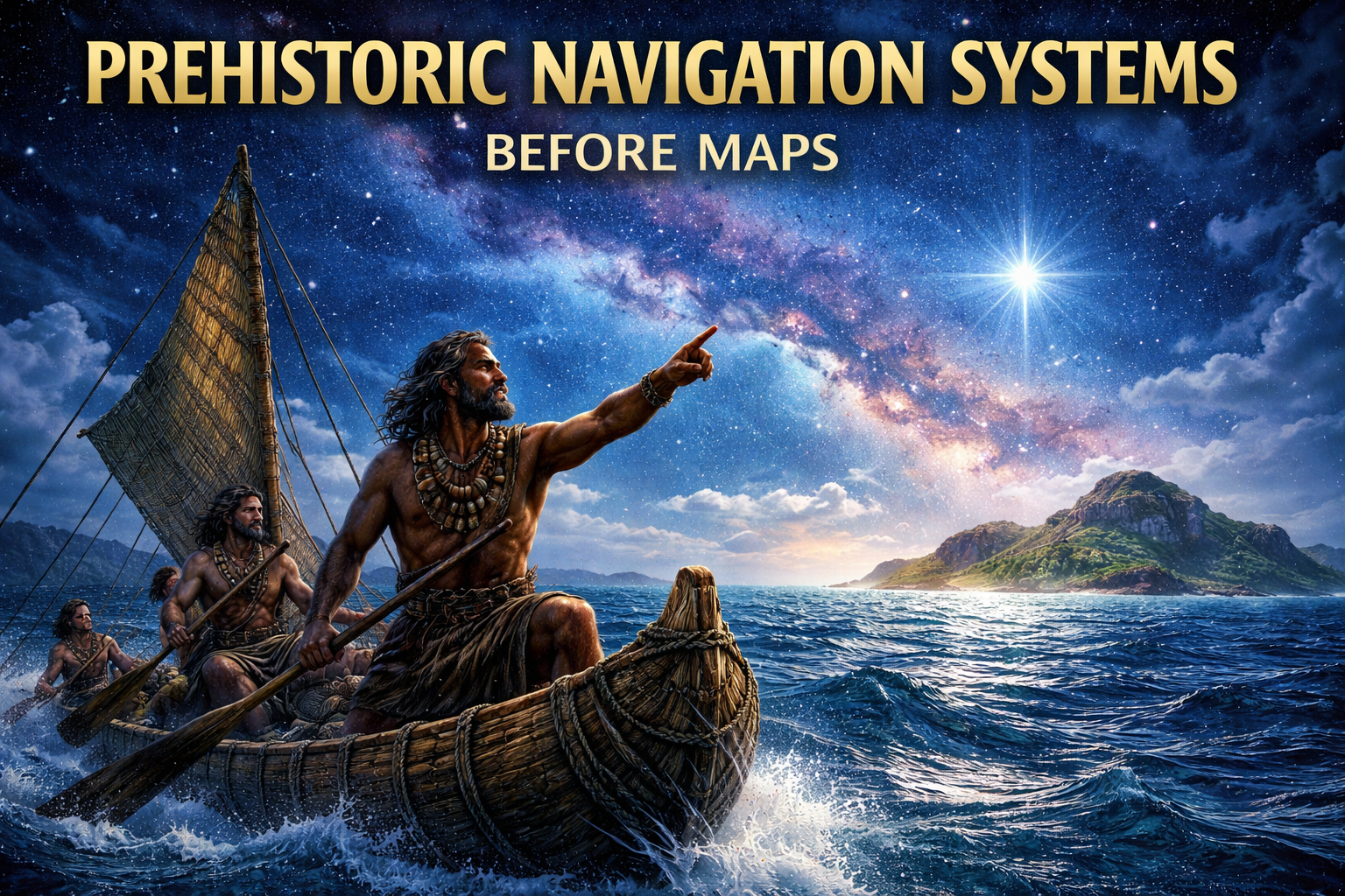
Celestial Orientation and Early Wayfinding
A fundamental component of early navigation was the use of the sky as a stable reference system, where the predictable motion of celestial bodies provided consistent directional cues that could be relied upon across seasons and environments (Lost Knowledge From Ice Age Rewriting History – link). The observation of star movements, particularly their rising and setting positions along the horizon, allowed navigators to maintain orientation during long-distance travel, while the identification of circumpolar stars offered a fixed point around which the night sky appeared to rotate, effectively establishing a natural compass (Science Before the Younger Dryas – link).
In later documented traditions, such as those of Polynesian navigators, this knowledge evolved into structured systems where star paths were memorized and used sequentially to guide voyages across open ocean, suggesting that the sky was not merely observed but systematically organized into a functional navigational framework. While direct evidence from deep prehistory is limited, the sophistication of these later systems implies a long developmental lineage, raising the possibility that similar principles were already in use tens of thousands of years earlier.
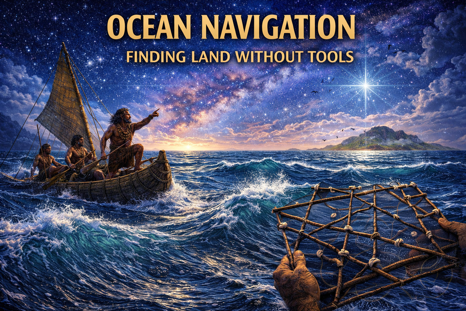
Reading the Ocean — Waves, Currents, and Wind
Beyond celestial cues, early navigators appear to have possessed an extraordinary sensitivity to the ocean itself, reading wave patterns, currents, and wind direction as if they formed a living map. Subtle shifts in swell direction, interference between wave systems, and even changes in water color or temperature could hint at unseen landmasses, raising the question of just how refined these observational skills truly were. Could such precision—combined with clues like migratory bird routes and persistent cloud formations over islands—point not merely to survival knowledge, but to a highly developed environmental science now lost to time?
This type of knowledge suggests a deeply embodied system of learning, where navigation depended less on instruments and more on perception trained over generations. If entire coastal cultures once thrived on now-submerged shorelines, might they have developed even more advanced techniques, refined through constant interaction with complex marine environments? The idea becomes even more compelling when considering that regions now underwater may have hosted communities whose navigational expertise far exceeded what we typically attribute to prehistoric peoples.
When we look at archaeological discoveries such as the submerged structures near Yonaguni Monument or the ancient coastal settlements off the coast of Dwarka, it raises an intriguing possibility: were these societies not only seafarers, but masters of oceanic interpretation? If so, how much of their knowledge disappeared along with the landscapes they once inhabited?
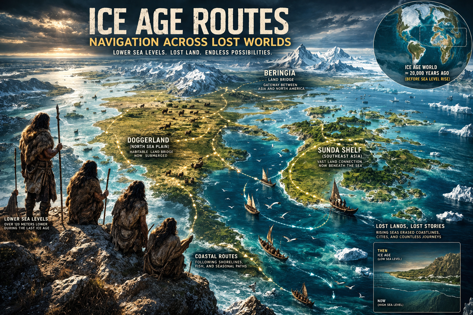
A Different World — Ice Age Landscapes and Routes
Understanding early navigation requires reimagining a radically different Earth—one shaped by Ice Age conditions, where sea levels were dramatically lower and vast landmasses now hidden beneath the ocean formed continuous migration corridors. Regions such as Doggerland, Sunda Shelf, and Beringia were not marginal zones, but thriving landscapes that may have supported complex human activity. If these areas were densely inhabited, what kinds of knowledge systems—including navigation—might have developed there, only to vanish beneath rising seas?
Even within these expanded landscapes, waterways, shifting coastlines, and seasonal changes would have required careful planning and directional awareness. This suggests that early humans were not merely wandering but deliberately navigating, potentially using repeatable routes and shared knowledge networks. Could this imply organized exploration, trade, or even cultural exchange across regions we now consider isolated?
The disappearance of these landscapes presents a profound challenge: if entire ecosystems and settlements now lie underwater, how much evidence of advanced human behavior has been erased? Discoveries like the submerged ruins of Pavlopetri hint that coastal civilizations have been lost before—so is it unreasonable to wonder whether far older, equally sophisticated societies once existed on Ice Age shores?
Memory, Storytelling, and Spatial Knowledge
Without written maps, prehistoric navigation relied on memory systems of remarkable complexity, often encoded in oral traditions that blended storytelling with practical instruction. Routes, landmarks, and environmental cues were embedded in narratives, songs, and rituals, transforming culture itself into a navigational archive. This raises an intriguing question: were ancient myths simply symbolic, or do they preserve fragments of real geographic knowledge now obscured by time?
Such cognitive mapping systems suggest that the human mind functioned as a living database, capable of storing and transmitting vast amounts of spatial information. In traditions like the songlines of Indigenous Australia, landscapes are remembered through sequences of stories tied to physical locations—an approach that may echo much older, globally widespread practices. If similar systems existed in now-submerged regions, could entire “mental maps” of lost worlds have been carried forward in distorted or mythologized forms?
Artifacts from across the globe deepen this mystery: the precision of the Antikythera Mechanism, the alignment of Göbekli Tepe, and the cartographic hints in the Piri Reis map all suggest that ancient peoples may have possessed unexpectedly advanced spatial awareness. Could these be isolated achievements—or fragments of a much older intellectual tradition, preserved imperfectly through memory and story?
Conclusion: Systems Without Instruments
The evidence surrounding prehistoric navigation points toward a level of sophistication that challenges conventional assumptions about early human capabilities. Rather than relying on tools, these systems integrated observation, memory, and environmental awareness into a cohesive method of movement across vast and often hostile terrains. This invites a deeper question: are we underestimating not only their abilities, but the possibility that entire knowledge systems—perhaps even civilizations—have been lost?
When we consider global anomalies such as the construction of Puma Punku or the astronomical precision of Nabta Playa, it becomes harder to view prehistoric societies as uniformly “primitive.” Instead, these examples hint at pockets of advanced understanding that may have emerged, flourished, and disappeared under changing environmental conditions. How many such centers of knowledge might have existed along coastlines now buried beneath the sea?
Ultimately, prehistoric navigation systems may represent not a beginning, but a remnant—survivals of a deeper human past that we are only beginning to rediscover. If rising seas erased entire landscapes and cultures, then what remains may be just enough to suggest a far more complex story, one in which lost civilizations and sophisticated knowledge systems are not merely speculative, but increasingly plausible.
References & Further Reading
Polynesian Voyaging Society — Traditional Wayfinding – link
NOAA — Ocean Dynamics and Navigation
Nature — Human Migration and Coastal Routes
Encyclopaedia Britannica — Navigation History
Journal of Anthropological Archaeology – link
Ancient360 — Submerged Civilizations & Ancient Maps – link