Skip to content
  • Ancient Maps
  • Archeoastronomy
  • Cosmic Alignments
  • Megalithic Structures
  • Geoglyphs
  • Sacred Geometry
  • Latest Videos
Menu
  • Ancient Maps
  • Archeoastronomy
  • Cosmic Alignments
  • Megalithic Structures
  • Geoglyphs
  • Sacred Geometry
  • Latest Videos
Facebook-f Instagram
Ice Age Routes

Ice Age Navigation Routes

April 6, 2026

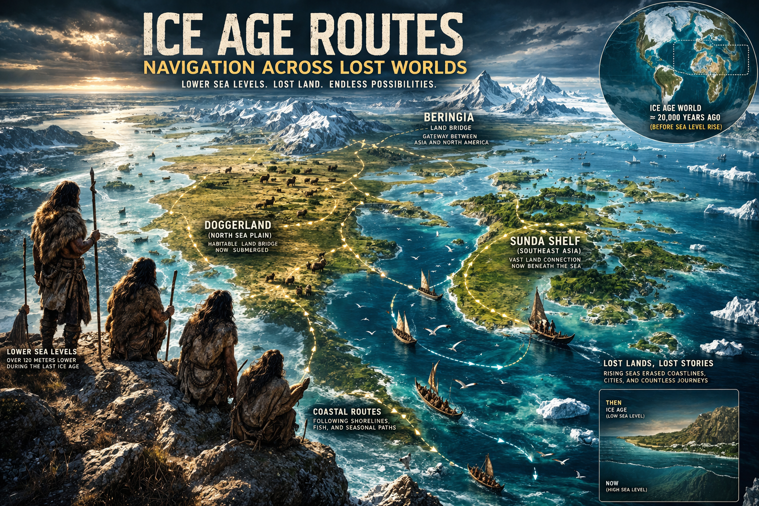
A World That No Longer Exists The study of ice age navigation routes introduces a fundamentally different geographical framework for

Read More »
Ancient Ocean Navigation Before Maps

Ancient Ocean Navigation — Finding Land Without Tools

April 6, 2026

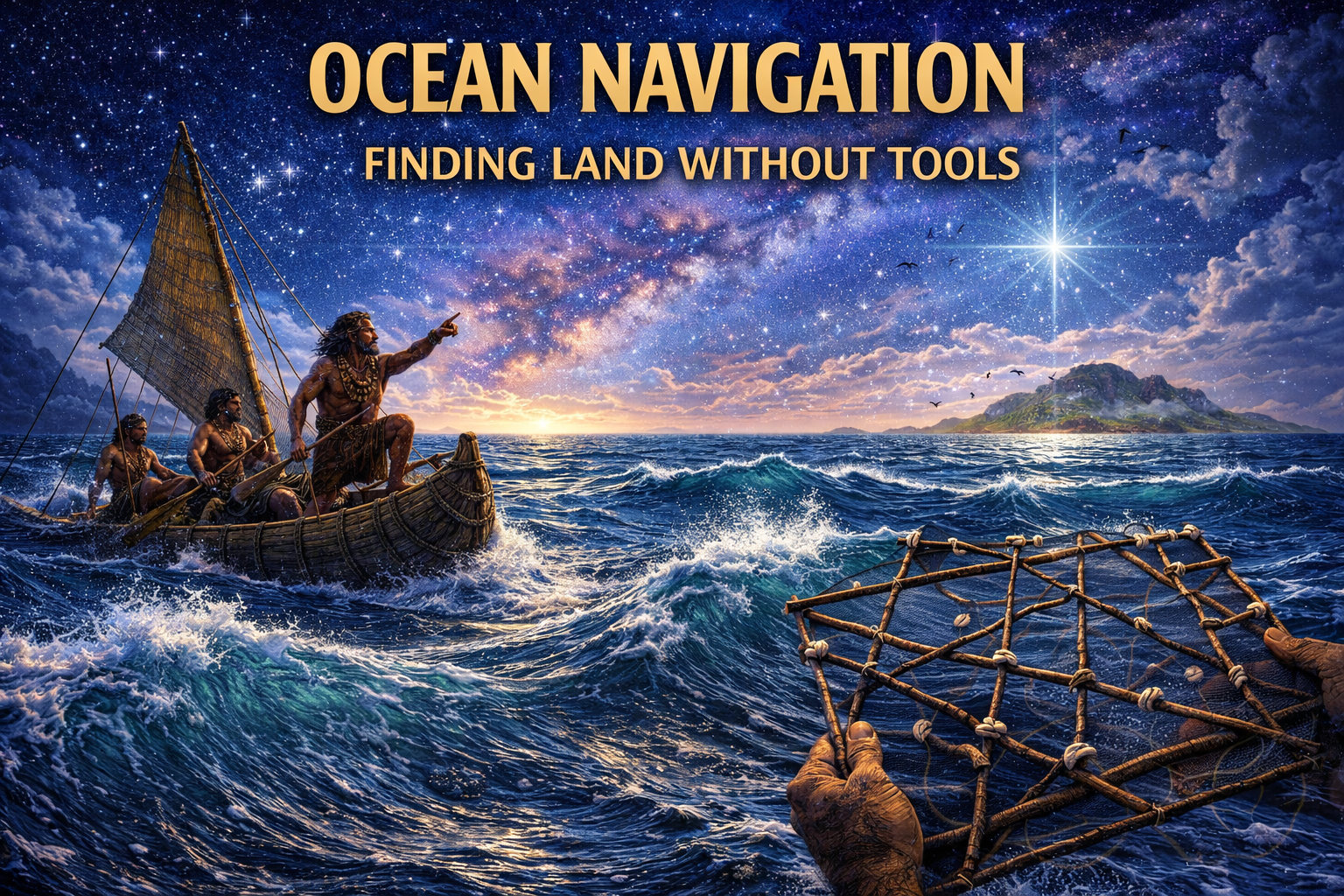
Ancient Navigation Without Instruments The study of ancient ocean navigation reveals a form of knowledge that operates almost entirely outside

Read More »
Celestial Navigation Before Science

Celestial Navigation — Ancient Mapping the Sky

April 6, 2026

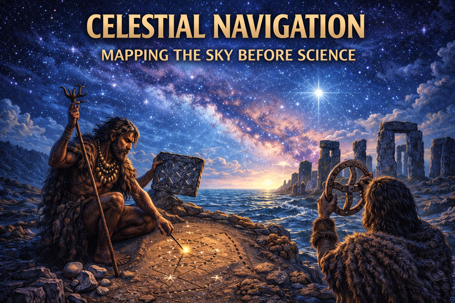
Celestial Navigation Before Science The concept of celestial navigation ancient systems represents one of the most profound yet often underestimated

Read More »
Prehistoric navigation systems before maps

Prehistoric Navigation Systems — Before Maps

April 4, 2026

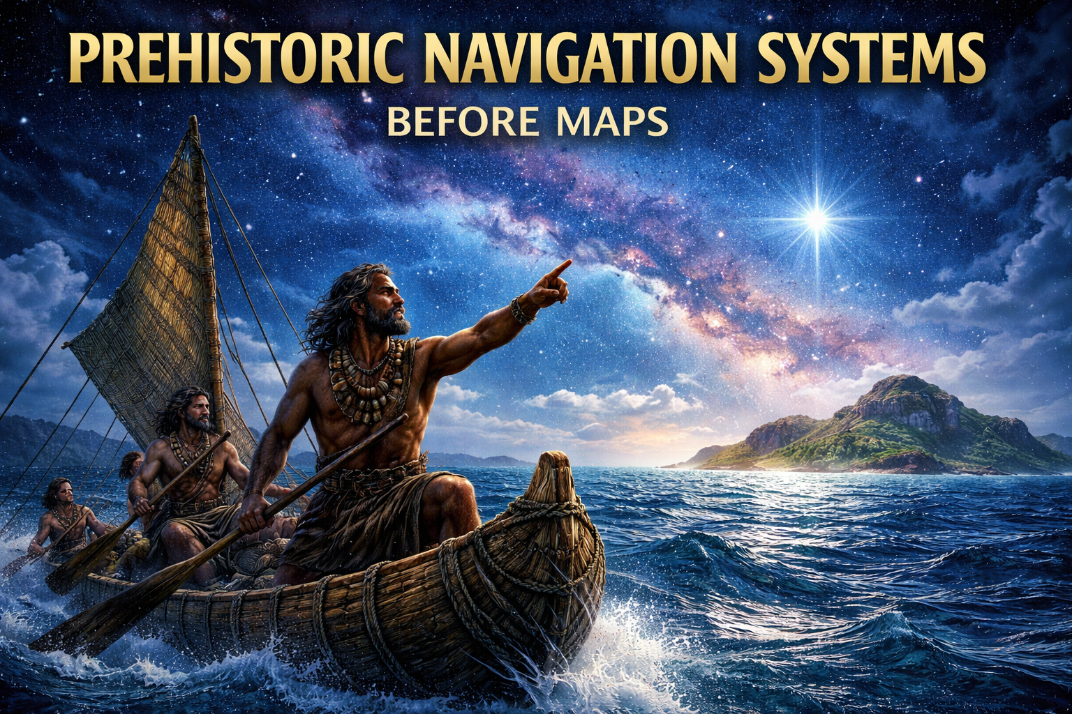
Navigation Before Written Maps The study of prehistoric navigation systems opens a critical window into how early human populations traversed

Read More »
Ancient Connection Across Earth and Sky

Ancient Knowledge Networks: Mapping Earth and Sky

February 26, 2026

Connecting Earth, Sky, and Knowledge The concept that ancient civilizations integrated knowledge of the Earth and the heavens sky into

Read More »
Ancient Maps and Star Charts: Lost Knowledge Traditions

Ancient Maps and Star Charts: Lost Knowledge Traditions

February 25, 2026

Mapping the Cosmos and the Earth The history of civilization is inseparable from the history of mapping. From the earliest

Read More »
cosmic orientation of ancient cities

Cosmic Orientation of Ancient Cities

February 25, 2026

When Civilization Followed the Heavens Throughout antiquity, humanity did not build randomly upon the surface of the Earth. Across continents

Read More »
A facsimile of the Zeno map in J. Winsor, Narrative and Critical History of America, vol. I, New York, Houghton-Mifflin-Company, 1889, p. 127. Courtesy the private collection of R. Winkelman

The Zeno Map: An Atlantic Cartographic Enigma

February 25, 2026

Phantom Islands in the North Atlantic The Zeno Map, first published in Venice in 1558, is one of the most

Read More »
Gerardus Mercator’s 1569 map showing Terra Australis/Antarctica with his portrait on the left side, in a historical aged paper style.

Gerardus Mercator Map of Antarctica

February 25, 2026

The Sources and Historical Context of the Gerardus Mercator Map The Gerardus Mercator map represents one of the most influential

Read More »
Eighteenth-century style world map showing a divided Antarctic continent with portrait of Philippe Buache beside the map.

Philippe Buache Map of Antartica

February 25, 2026

The Sources and Historical Context of the Philippe Buache Map The Philippe Buache map represents one of the most debated

Read More »
Page1 Page2 Page3 Page4
Latest Video
Most Popular
Ancient Water Systems
May 18, 2026
Acoustic Engineering Ancient Structures
May 17, 2026
Stone Functional Material
May 17, 2026
Lost Ancient Technologies
Systems vs Tools: Reconstructing Lost Ancient Technologies
May 14, 2026
Categories
  • Ancient Maps (34)
  • Archeoastronomy (22)
  • Cosmic Alignments (17)
  • Foundations (59)
  • Geoglyphs (11)
  • Megalithic Structures (72)
  • Sacred Geometry (44)

COMPLETE YOUR JOURNEY

RECEIVE UPDATED STORIES FROM THE ANCIENT MASTERS

Ancient360 © 2022 ALL RIGHTS RESERVED.

Disclamer

Facebook-f Instagram