The Iberian civilization that vanished. According to the National Geographic, a study that a multidisciplinary team of researchers from the University of Huelva, the Consejo Superior de Investigaciones Científicas (CSIC) and the Fundación del Hogar del Empleado (FUHEM) has just published in the journal Frontiers in Marine Science suggests that the legendary city of Tartessos may have been located in what are now the marshes of the Doñana National Park, in the province of Huelva.
The recent study of the paleo-environmental and paleogeographic conditions of this natural area, covering the period between 1150 and 500 B.C., has revealed that the landscape would have been very different from the present one in the area and, according to the researchers, “agrees with the descriptions of the region offered by ancient authors, most notably the description of the 4th century A.D. Roman writer Rufus Festus Avienus in his poem Ora Maritima based on Latin, Greek and even Carthaginian texts”
Avieno lived centuries after the decline of this ancient civilization that developed in the south of the Iberian Peninsula and located its political and commercial center on an island called Cartare (a toponym of Phoenician origin meaning “the island of the city”), located between the two branches of a river also called Tartessos that came from the Lacus Ligustinus (Lake Ligustinus or Lake Ligurian).
THE DESCRIPTION OF AVIENO
When Avienus visited Cadiz in the 4th century A.D., the Guadalquivir estuary had one mouth instead of two, and the Lacus Ligustinus had become a marshy area. Already in the 18th century, the Dane G. Schöning was the first to discover that Avienus had probably used the route of an unknown Greek navigator or merchant of the 6th century BC, who lived in the time of the last documented Tartessian king, Argantonius, who, according to the Greek historian Herodotus, had commercial relations with the Ionian city of Focea, in present-day Turkey.
“It is likely that Avieno was based on at least two navigation routes of the early sixth century BC: one for navigation from the North Atlantic to the political and commercial center of Tartessos and the other for navigation from this center to the colony of Marseilles, founded by settlers from Focea,” the authors of the study emphasize.
In a statement, the CSIC researchers point out that although Avieno’s description of this landscape and many others in the Gulf of Cadiz has always puzzled historians, recent geological studies and reconstruction of the natural environment of the past “would explain this discordance”.
A DIFFERENT LANDSCAPE
When the first Phoenician explorers and merchants arrived in the southwest of the Peninsula during the Bronze Age, the region had been repopulated after the tsunami that hit the Gulf of Cadiz around 1150 BC and flooded much of the marshes of present-day Doñana.
The researchers have been able to identify in the area the traces left by the ancient low river courses, the coastal lagoon and the oceanic coastline. “The study of all these formations, as well as the determination of their antiquity, allow us to reconstruct each of the landscapes that the Natural Area and its surroundings have known since the Middle Holocene, about 5,500 years ago, until the present,” they point out.
It has also been possible to estimate the extension and surface of the coastal lagoon in the first half of the first millennium BC, corresponding to the period of Tartessos, as well as its communication routes with the ocean.
According to this research, the Guadiamar river flowed into the lagoon through the Travieso pipe, almost in the meridian of the present town of Aznalcázar, today captured by the so-called Brazo de La Torre (one of the great branches that made up the Guadalquivir River). For its part, the lost branch of the Guadalquivir, according to researchers, “was to the east of the current and not to the west of it, as mistakenly thought the German Adolf Schulten and the Anglo-French George E. Bonsor in the 1920s.
WAS TARTESSOS IN THE ALGAIDA?
In the opinion of the authors of the study, “the Tartessos river cited by Avieno would be the current Guadiamar, running in its last stretch through the Travieso channel. After flowing into Lake Ligustino, which would be the coastal lagoon, the river would leave it and surround La Algaida, an island then, which would be Cartare, before reaching the Atlantic divided into two branches”.
The hypothesis of the researchers according to which Tartessos would be on the island of La Algaida, today on the left bank of the Guadalquivir River, would coincide with that formulated by the researchers Pedro Barbarillo in the 1940s and by the Frenchman Loïc Menanteau in the 1970s.
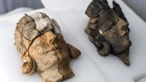
Finally, in the opinion of the researchers, this study “should serve to rehabilitate the credibility of the Ora Maritima of Avieno as a historical source of Iberia in the 6th century BC and renew interest in other ancient writings on Tartessos”. As Celestino Perez explained, “What seems to be the Tartessian port of Huelva has been located. If confirmed, it could be a giant step to understanding the Tartessian trade network. And the so-called Tartessian tombs of the Guadiana [Cancho Roana, Turuñuelo and La Mata] seem to have the key to know this culture better.” With lost underwater civilizations and cities being rediscovered, could the Atlantis or parts of its controlled territories been in what is today Southern Spain? The most recent discoveries point to cities of ancient underwater civilizations that were submerged by water or a deluge. So could the Tartessos had linked with ancient Atlantis? Or could Atlantis have been in Andalusia Spain?
SOURCE:
National Geographic – Un estudio revela donde pudo ubicarse la mítica ciudad de Tartessos LINK
BBC – The Iberian civilization that vanished LINK
VICE – Archaeologists Uncover the Ancient Gods of a Lost Civilization in Stunning Find LINK