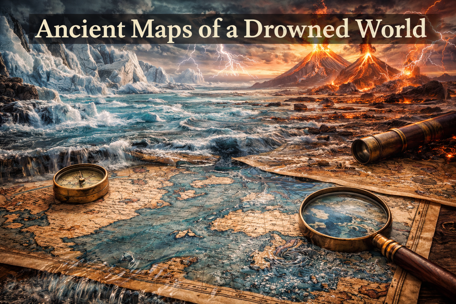
Ancient Maps of a Drowned World: Echoes of Lost Civilizations
The concept of an ancient maps drowned world challenges conventional history by suggesting that early cartographers preserved knowledge of coastlines and lands that no longer exist above sea level. Across multiple ancient maps—created centuries or even millennia apart—we find recurring depictions of submerged territories that align not with medieval geography, but with Ice Age sea levels.
This raises a fundamental question: how could ancient mapmakers depict a world that disappeared thousands of years before their time?
Ice Age Sea Levels and the Lost Geography of Earth
During the Last Glacial Maximum (approximately 26,000–19,000 years ago), global sea levels were up to 120 meters lower than today. Vast continental shelves were exposed, including:
-
Sundaland in Southeast Asia
-
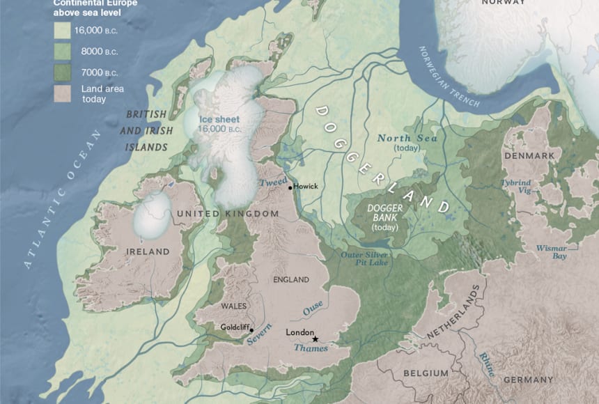
Doggerland in the North Sea
-
Extended coastlines around Antarctica
-
Larger Mediterranean land bridges
Modern marine geology confirms these submerged landscapes—but ancient maps appear to remember them. This is where ancient maps drowned world theories intersect directly with hard science.
Ancient Maps That Preserve Submerged Lands
Several historical maps display geographic features that only make sense if their sources predate post-Ice Age flooding.
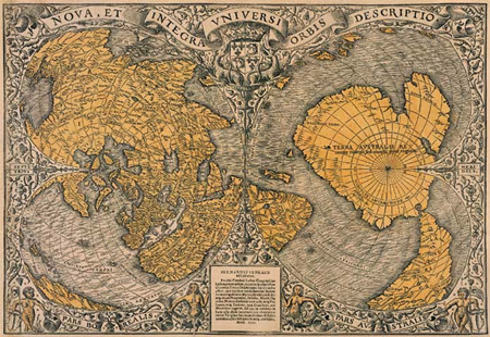
The Oronteus Finaeus Map (1531)
Depicts Antarctica as an ice-free continent with rivers and mountain ranges—features later confirmed by radar surveys beneath the ice.
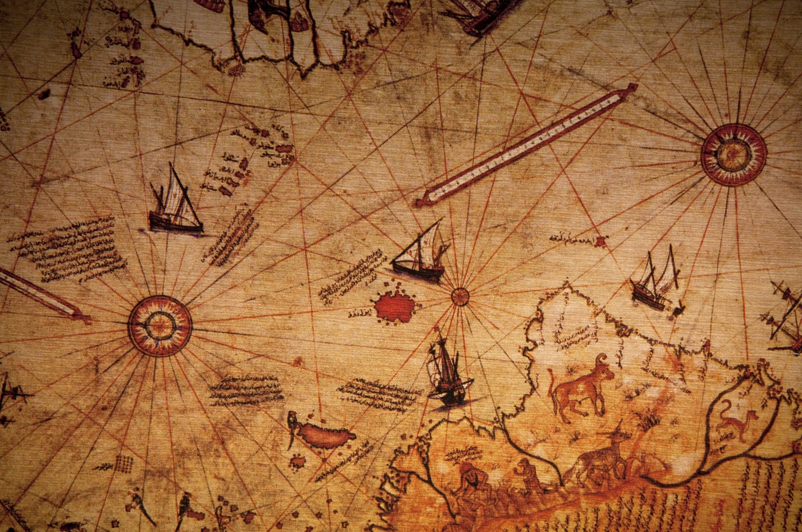
The Piri Reis Map (1513)
Shows coastlines consistent with Ice Age sea levels, particularly in South America and possibly Antarctica, linking directly to the Piri Reis map history explored in Part 2.
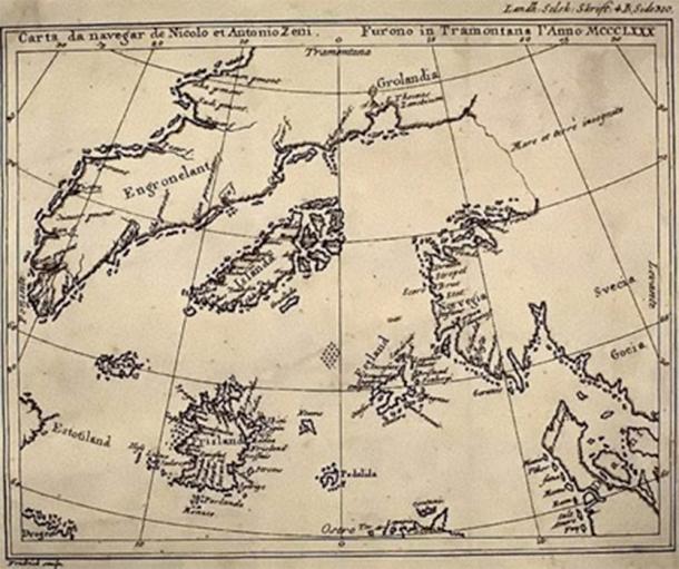
The Zeno Map (1380)
Portrays lost North Atlantic islands where submerged plateaus exist today, suggesting a memory of lands drowned after the Ice Age.
Each reinforces the ancient maps drowned world hypothesis: these maps are compilations of far older sources.
Oral Memory, Myth, and Cartographic Transmission
Before writing systems, knowledge survived through:
-
Oral traditions
-
Sacred geography
-
Monumental architecture
-
Astronomical encoding
Just as archeoastronomy preserved celestial events across millennia, ancient maps may have preserved geographic memory—passed down, copied, and reinterpreted.
This explains why Plato’s Atlantis, flood myths, and submerged lands appear globally synchronized.
Younger Dryas, Catastrophe, and Global Flood Memory
The Younger Dryas event (~10,800 BCE) coincides with:
-
Rapid sea-level rise
-
Massive flooding
-
Abrupt climate change
This timeline aligns with:
-
Göbekli Tepe’s construction
-
The end of Ice Age coastlines
-
The sudden disappearance of large landmasses
The ancient maps drowned world may therefore reflect a pre-cataclysmic Earth, preserved through fragmented knowledge systems.
Why This Matters
If ancient maps truly reflect a drowned world, then human history does not begin with agriculture—but with survival after catastrophe.
This reframes ancient civilizations not as primitive ancestors, but as inheritors of a deeper, fragmented past.
The maps are not fantasies.
They are memories.
Additional Readings & Reputable Sources
-
Hapgood, C. Maps of the Ancient Sea Kings – link
-
NOAA – Ice Age Sea Level Data – link
-
British Antarctic Survey – Subglacial Mapping
-
National Geographic – Doggerland – link
-
Scientific American – Paleoclimate & Younger Dryas – link
- Ancient Maps & Knowledge Before Modern Cartography – link