
Gerardus Mercator Map of Antarctica
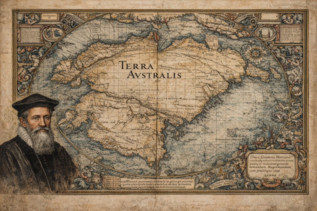
The Sources and Historical Context of the Gerardus Mercator Map The Gerardus Mercator map represents one of the most influential and scrutinized artifacts in the history of cartography, depicting a southern continent long before Antarctica was officially discovered. Created in 1569 as part of Mercator’s groundbreaking world map, it incorporates the hypothetical landmass of Terra […]
Philippe Buache Map of Antartica
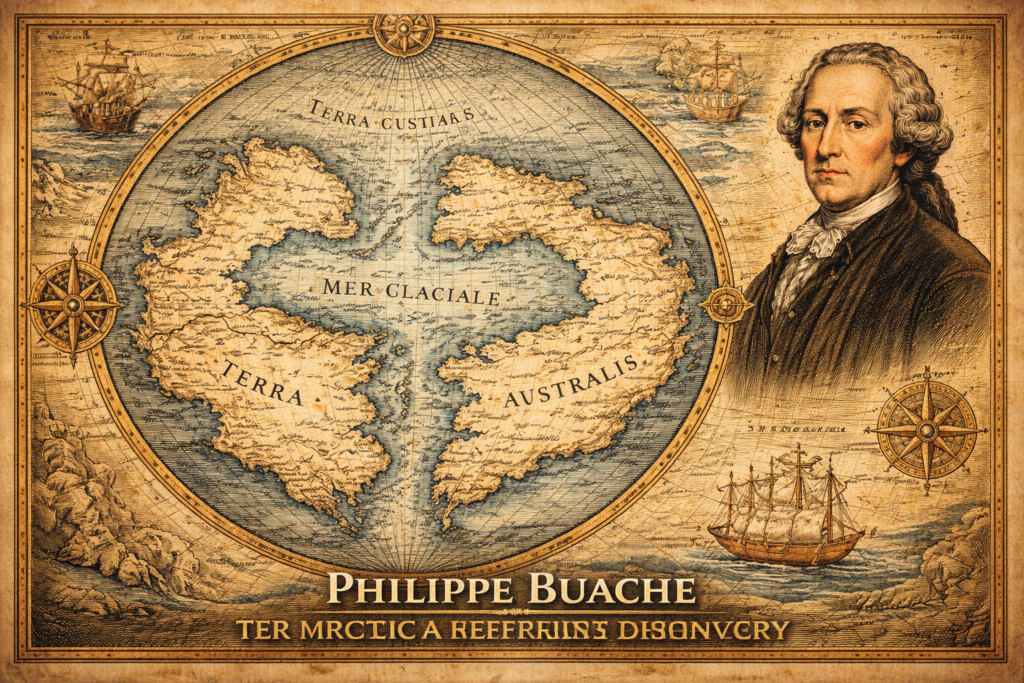
The Sources and Historical Context of the Philippe Buache Map The Philippe Buache map represents one of the most debated artifacts in the history of cartography, presenting a depiction of Antarctica that appears to include structural geographic features long before the continent was officially discovered in the nineteenth century, thereby raising fundamental questions regarding the […]
Terra Australis Hypothesis
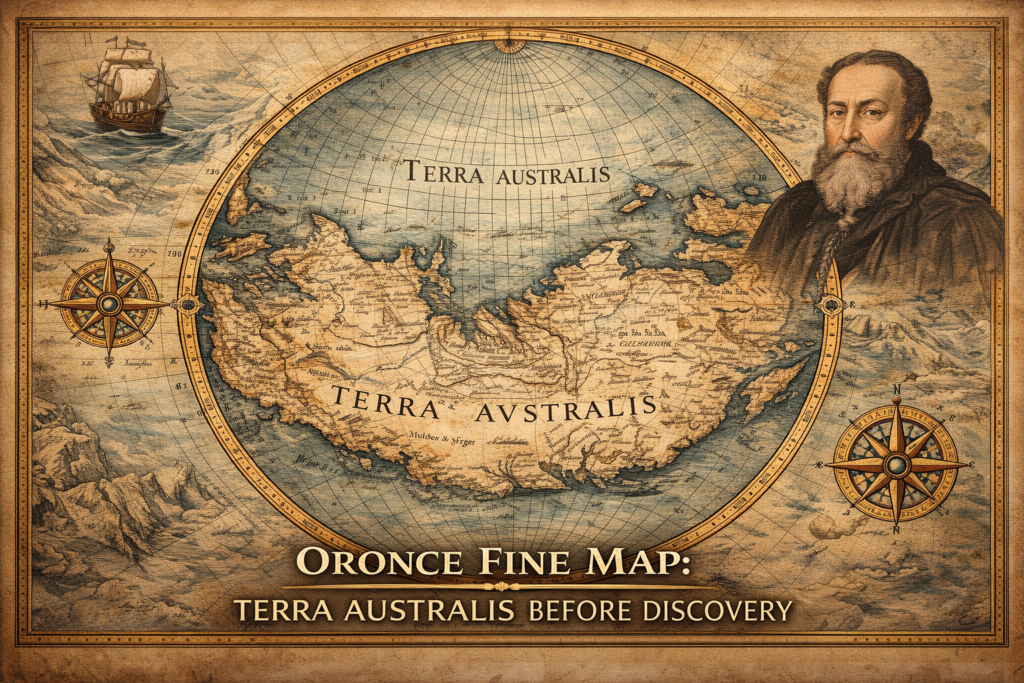
The Terra Australis Hypothesis and the Legacy of Ancient Cartography The terra australis hypothesis represents one of the most intriguing questions in the history of geographic knowledge, suggesting that a vast southern continent was mapped and theorized centuries before the modern discovery of Antarctica, raising fundamental questions about how early civilizations understood the world and […]
Ancient Maps of a Drowned World: Echoes of Lost Civilizations

Ancient Maps of a Drowned World: Echoes of Lost Civilizations The concept of an ancient maps drowned world challenges conventional history by suggesting that early cartographers preserved knowledge of coastlines and lands that no longer exist above sea level. Across multiple ancient maps—created centuries or even millennia apart—we find recurring depictions of submerged territories that […]
Ancient Maps: Knowledge Before Modern Cartography

Ancient Maps: Knowledge Before Modern Cartography Why Ancient Maps Still Disturb Modern Assumptions Ancient maps are often presented as crude, symbolic, or speculative attempts by early civilizations to understand their world. This assumption is comforting—but increasingly difficult to defend. When examined carefully, many ancient maps display levels of geographic accuracy, astronomical awareness, and mathematical sophistication […]
Ancient Maps: Windows into Early Worldviews

Maps are more than mere tools for navigation—they are windows into how ancient civilizations perceived the world, blending geography, mythology, and political knowledge. From Babylon to the Ottoman Empire, these early cartographic artifacts reveal humanity’s enduring fascination with charting the unknown. Imago Mundi: The Babylon Map of the World (British Museum, UK) Known as the […]
