
The Zeno Map: An Atlantic Cartographic Enigma

Phantom Islands in the North Atlantic The Zeno Map, first published in Venice in 1558, is one of the most enigmatic cartographic artifacts of the Renaissance. Allegedly based on the voyages of two 14th-century Venetian brothers, Nicolò and Antonio Zeno, it depicts a cluster of islands—Frisland, Icaria, Estotiland, and Drogeo—lying between Iceland, Greenland, and the […]
The Zeno Map History
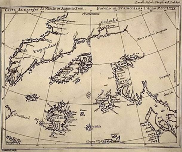
The Zeno Map History and the Problem of Forgotten Geography The Zeno Map history occupies a controversial yet fascinating position within the study of ancient maps. First published in 1558 by Nicolo Zeno the Younger, the map was claimed to be based on far older navigational charts and letters written by his ancestors, the Venetian […]
