Ancient Navigation Without Instruments
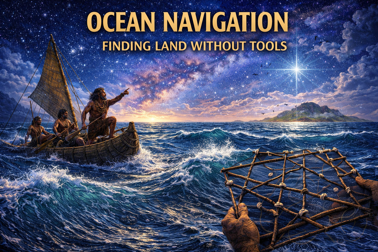
The study of ancient ocean navigation reveals a form of knowledge that operates almost entirely outside the framework of modern technological dependence, demonstrating that long before compasses, sextants, or maps, human societies developed reliable methods for traversing vast and often featureless oceanic environments using nothing more than observation, memory, and deeply trained perception (Prehistoric Navigation Before Maps link). While the open ocean may appear uniform and disorienting to the untrained eye, it is in fact a highly structured and dynamic system, where waves, winds, currents, clouds, and living organisms all carry information that can be interpreted by those who understand how to read them (Lost Worlds Before the Flood link).
This challenges the assumption that navigation requires instruments to achieve precision, suggesting instead that the human sensory system—when refined through generations of practice—can function as an integrated navigational tool, capable of detecting subtle environmental patterns and translating them into actionable direction. Within this context, the ocean is not an empty void but a complex and information-rich landscape, and the navigators who mastered it were not merely travelers, but specialists operating within a highly developed knowledge system (Mapping the Sky Before Civilizations link).
Reading the Ocean Surface
At the core of ancient ocean navigation lies the ability to interpret wave patterns, particularly ocean swells, which are generated by distant weather systems and can travel thousands of kilometers across the sea while maintaining consistent directionality. Unlike local wind-driven waves, which are short-lived and chaotic, swells form long, regular patterns that can be detected even when they are subtle, providing a stable directional reference that persists regardless of immediate weather conditions (Ancient Mapping the Sky link).
Navigators trained in this system learn to feel the movement of the vessel relative to the swell, using their body as a sensor to detect orientation, even in darkness or low visibility, effectively internalizing the motion of the ocean as a form of directional awareness. This process requires not only physical sensitivity but also cognitive mapping, as multiple swell systems can intersect, creating complex interference patterns that must be interpreted correctly to maintain course.
Wave Interference and Directional Stability
One of the more sophisticated aspects of ancient ocean navigation involves understanding how different wave systems interact, producing interference patterns that can reveal both direction and environmental context. When swells from different origins intersect, they create predictable cross-patterns that can be used to triangulate orientation, allowing navigators to maintain a steady heading even when individual wave directions become ambiguous (Cities Beneath Ice Age link).
This phenomenon is particularly important near island chains, where reflected waves from landmasses interact with incoming swells, creating distinctive patterns that signal proximity to land even when it is not yet visible (Lost Knowledge of Ice Age link). Such knowledge transforms the ocean into a readable surface, where subtle variations in wave behavior carry meaningful information, effectively functioning as a form of natural signaling system.
Wind, Currents, and Drift Awareness
Beyond waves, ancient ocean navigation integrates a sophisticated understanding of wind patterns and ocean currents, both of which continuously shape the movement of a vessel and must be accounted for to maintain an intended course (Ancient Knowledge Network link). Wind offers immediate, visible cues—its direction, strength, and consistency directly influencing speed and heading—while currents operate more subtly, introducing gradual drift that can carry a navigator far off course over time if left uncorrected. This raises an important question: how early did humans begin not just noticing these forces, but systematically predicting and compensating for them?
Navigators develop an acute awareness of these variables through constant observation, learning to “feel” the ocean as much as read it. The angle of the swell, the resistance against a vessel, and even the behavior of floating debris can all signal the presence of underlying currents moving in a different direction than the wind above (Ancient Maps and Star Charts link). Could such sensitivity represent a form of environmental intelligence that rivals modern instrumentation in its own context?
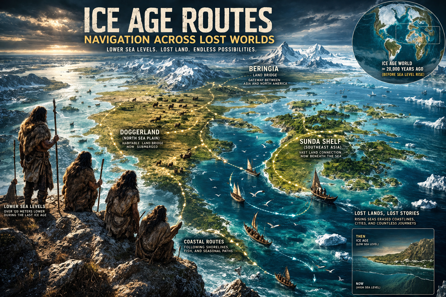
In regions like the Pacific, the predictable flow of currents such as the Kuroshio Current would have offered both opportunity and danger, acting as a kind of invisible highway for those who understood it. Similarly, the seasonal wind systems of the Indian Ocean monsoon system enabled long-distance travel long before written records describe such voyages. If these patterns were known and intentionally used, does this suggest organized navigation networks extending far deeper into prehistory than currently acknowledged?
What makes this even more compelling is the cumulative nature of such knowledge—it cannot be learned instantly, but must be refined across generations (Cosmic Orientation of Ancient Cities link). This implies stable traditions, repeated voyages, and perhaps even specialized roles within societies dedicated to mastering these environmental systems. If coastal civilizations once existed on now-submerged shores, how advanced might their understanding of these forces have become?
Ultimately, drift awareness reflects a dynamic, adaptive form of navigation, where course is not fixed but constantly negotiated with the environment. Rather than resisting nature, ancient navigators appear to have worked in harmony with it, suggesting a level of sophistication that challenges the notion of “primitive” seafaring. Could it be that what we see today are only the surviving fragments of a once far more comprehensive and possibly global maritime knowledge system?
Birds, Clouds, and Signs of Land
A critical component of ancient ocean navigation involves recognizing biological and atmospheric signals that indicate the presence of nearby land, transforming the open ocean into a landscape rich with subtle clues. Among the most reliable of these are seabirds, whose daily and seasonal movement patterns can reveal the direction and distance of landmasses beyond the horizon. Species such as the frigatebird are known to travel far from land during the day but must return to roost at night, offering navigators a living compass if their behavior is carefully observed.
Cloud formations provide another layer of information, particularly in tropical regions where islands influence local weather systems. Landmasses can generate persistent cloud cover due to heat rising from the Earth, creating formations that remain fixed in one location while other clouds drift past. Could ancient navigators distinguish between transient and stationary clouds well enough to identify unseen islands from dozens of kilometers away?
Water itself also carries clues, with changes in color, clarity, and debris indicating shifts in depth or proximity to shore. Lighter shades of blue or green may signal shallow waters over sandbanks or reefs, while floating vegetation or driftwood can suggest land nearby. In some cases, even the presence of certain smells—carried by the wind—might have hinted at vegetation or soil beyond the horizon.
Archaeological and historical accounts, including the use of birds by Norse explorers searching for land near Iceland, suggest that these techniques were not isolated but widely understood. If multiple cultures independently developed similar methods, does this point to a shared body of knowledge that stretches further back in time? Or could it hint at lost interactions between seafaring peoples whose histories are no longer visible?
Taken together, these signs form a complex, multi-sensory system of navigation that extends far beyond simple direction-finding. They suggest that ancient mariners were not merely travelers, but careful observers of interconnected natural systems, capable of extracting meaning from patterns that modern observers might overlook. If such knowledge once flourished in regions now submerged or erased by climatic upheaval, then what remains today may be only a faint echo of a far richer understanding of the natural world—and of humanity’s place within it.
Cognitive Mapping and Memory Systems
Unlike modern navigation, which relies on external tools, ancient ocean navigation is fundamentally internal, requiring navigators to build and maintain complex mental maps that integrate spatial, environmental, and temporal information. These maps are not static representations but dynamic systems that evolve in real time as conditions change, allowing navigators to adapt their strategies based on new observations (Ancient Maps link).
The development of such cognitive systems requires extensive training, often beginning in childhood, where apprentices learn to recognize patterns, memorize routes, and interpret environmental cues under the guidance of experienced navigators. Over time, this knowledge becomes deeply embedded, enabling individuals to navigate with a level of confidence and precision that appears almost intuitive but is in fact the result of rigorous and sustained learning (Ancient Navigation Technology Evidence of Lost Survey methods link).
Marshall Islands Stick Charts — Abstract Ocean Maps
One of the few physical representations associated with ancient ocean navigation is the stick charts of the Marshall Islands, which encode information about wave patterns, currents, and island positions using a system of sticks and shells. These charts are not used directly during navigation but serve as teaching tools, helping navigators visualize the complex interactions of ocean forces and internalize them before embarking on voyages (Ancient Maps Echoes of Lost Civilizations link).
The existence of such abstract representations suggests that navigational knowledge was not only experiential but also conceptual, capable of being externalized and communicated through symbolic systems, even in the absence of written language. This reinforces the idea that ancient navigation was structured and systematic, rather than purely instinctive.
The Ocean as a Structured Environment
From a modern perspective, the ocean may appear as an unpredictable and chaotic environment, yet ancient ocean navigation demonstrates that it can be understood as a structured system governed by consistent physical principles. Waves propagate according to predictable dynamics, currents follow established paths, and environmental indicators provide reliable signals that can be interpreted by trained observers.
This reframing of the ocean as an information-rich environment aligns with the broader Ancient360 perspective, where knowledge emerges not from the invention of tools but from the recognition and interpretation of patterns within the natural world. In this sense, navigation becomes less about imposing order and more about discovering the order that already exists.
Conclusion: Perception as Technology
The study of ancient ocean navigation ultimately reveals a form of expertise that challenges modern assumptions about the relationship between technology and capability, suggesting that human perception, when refined and structured through cultural transmission, can function as a highly effective navigational system. Rather than relying on external instruments, early navigators developed internal systems that allowed them to interpret complex environmental data and translate it into precise movement across vast and often unforgiving landscapes.
This raises a broader question that extends beyond navigation itself: if such levels of sophistication were achieved without written science or mechanical tools, what other domains of prehistoric knowledge might have reached similar levels of complexity, and how much of that knowledge has been lost as technological paradigms shifted over time?
References & Further Reading
Polynesian Voyaging Society — Traditional Wayfinding – link
National Geographic — Polynesian Navigation
NOAA Ocean Explorer — Wave Dynamics
Journal of Navigation — Traditional Ocean Wayfinding
Encyclopaedia Britannica — Ocean Currents
Journal of Anthropological Archaeology – link
Ancient360 — Submerged Civilizations & Ancient Maps – link