When Civilization Followed the Heavens
Throughout antiquity, humanity did not build randomly upon the surface of the Earth. Across continents separated by vast oceans, ancient civilizations constructed cities, monuments, ceremonial centers, and sacred landscapes that appear deliberately oriented according to celestial phenomena. The cosmic orientation of ancient cities reveals a remarkable and recurring phenomenon: the built environment was designed to mirror the order observed in the sky, translating astronomical knowledge into geometry, measurement, and architecture.
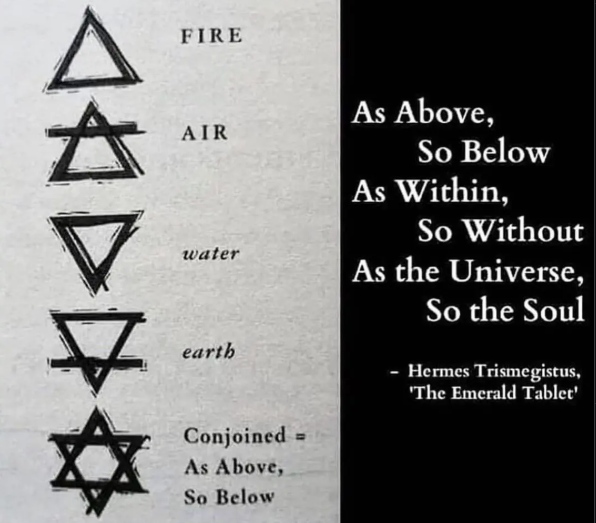
The ancient philosophical principle often summarized as “as above, so below; as within, so without; as the universe so the soul” appears repeatedly encoded in stone, urban planning, and sacred architecture. The heavens were perceived not merely as distant lights but as the fundamental structure of reality — a cosmic order governing time, seasons, kingship, agriculture, and the destiny of civilizations. To align earthly structures with celestial motion was to harmonize human existence with universal law.
The scientific field of Archaeoastronomy has increasingly demonstrated that these alignments are measurable, intentional, and technically sophisticated. Through satellite mapping, astronomical simulation, and archaeological research, scholars have shown that ancient builders possessed advanced knowledge of solar cycles, stellar motion, geometric surveying, and cardinal orientation.
Yet many fundamental questions remain:
-
How did ancient civilizations observe the sky with such precision?
-
Why did they dedicate immense labor to celestial alignment?
-
What mathematical and surveying methods did they use?
-
Did they employ maps and standardized measurements?
-
What intellectual traditions preserved and transmitted this knowledge?
-
Could part of this knowledge originate from earlier cultures now lost to history?
By examining some of the most remarkable examples of cosmic orientation — from Egypt to Mesoamerica, from Southeast Asia to the Indus Valley — a consistent pattern emerges: ancient civilizations sought to reproduce the structure of the cosmos on Earth.
How Ancient Civilizations Observed and Measured the Sky
Before modern instruments, the sky itself functioned as a precise observational laboratory. Over generations, ancient observers tracked recurring patterns: the rising and setting of the Sun, the phases of the Moon, the heliacal rising of stars, the shifting constellations, and the slow rotation of circumpolar stars around the celestial pole.
Common observational techniques included:
-
Solar shadow tracking using vertical poles (gnomons)
-
Horizon markers built from stone or natural landscape features
-
Sighting corridors within temples
-
Long-term recording of stellar positions
-
Geometric triangulation across landscapes
-
Water clocks and early time-measurement devices
Through repeated observation, ancient societies constructed solar and lunar calendars, determined seasonal cycles, and established cardinal directions. Important celestial references included Sirius in Egyptian timekeeping, Venus in Mesoamerican cosmology, Orion in funerary symbolism, and the Pleiades as seasonal indicators across multiple cultures.
These observations enabled the creation of standardized measurement systems, geometric planning methods, and large-scale surveying procedures that allowed entire cities to be oriented according to celestial principles.
Great Pyramid of Giza — True North and the Geometry of the Planet
Among all known examples of cosmic orientation in antiquity, the pyramids of the Giza plateau in Egypt represent perhaps the most striking demonstration of astronomical precision ever achieved by an ancient civilization. Constructed during the Fourth Dynasty around 2600 BCE, the Great Pyramid of Giza is aligned to true geographic north with an accuracy that continues to astonish modern engineers, surveyors, and astronomers. Its orientation deviates from true north by only a tiny fraction of a degree, an error margin so small that it rivals the precision of modern surveying techniques using advanced instruments.
This extraordinary alignment raises fundamental questions regarding the scientific knowledge possessed by ancient Egyptian builders. True north is not easily determined without careful astronomical observation. Unlike magnetic north, which shifts over time and varies depending on location, true north requires understanding the rotation of the Earth and the apparent motion of the celestial sphere. To establish this direction with such precision would have required systematic observation of circumpolar stars — stars that never set and appear to rotate around the celestial pole — over extended periods of time.
One widely discussed method suggests that Egyptian astronomer-priests may have tracked the simultaneous transit of two circumpolar stars across the meridian, using their alignment to establish a perfectly north–south axis. This technique implies not only observational patience but also an advanced conceptual understanding of celestial motion, seasonal variation, and geometric measurement. Whether achieved through stellar observation, solar shadow tracking, or a combination of methods, the result demonstrates a level of astronomical competence that cannot be explained by simple trial and error.
The Great Pyramid’s orientation is not an isolated phenomenon. The three major pyramids of the Giza plateau appear arranged in deliberate spatial relationship to one another, forming geometric patterns that reflect ordered planning rather than incremental construction. The precision of their base leveling, the consistency of their orientation, and the standardized measurement units used throughout the complex indicate a systematic surveying methodology based on reproducible procedures.
Equally remarkable is the precision of the pyramid’s base. The four sides of the Great Pyramid are nearly perfectly square, and the base is leveled to within a few centimeters across more than thirteen acres of surface area. Achieving such uniformity required sophisticated measurement tools, standardized units of length, and an understanding of large-scale geometric control. The ancient Egyptian royal cubit, used as a fundamental measurement unit, demonstrates consistent proportional relationships throughout the structure, suggesting a mathematical framework guiding construction.
The question inevitably arises: why did Egyptian builders pursue such extreme precision in orientation? The answer appears rooted in cosmology. For ancient Egyptian thought, the heavens represented eternal order, permanence, and divine stability. The circumpolar stars — often referred to as the “imperishable stars” — symbolized immortality and the eternal realm of the gods. By aligning monumental structures with these celestial reference points, Egyptian architects were embedding cosmic permanence into the built environment, creating structures intended to transcend time.
The pyramids therefore functioned not merely as tombs but as cosmological instruments, linking earth and sky through precise orientation. Their alignment established a symbolic axis between the terrestrial world and the celestial domain, reinforcing religious beliefs concerning the pharaoh’s transformation and ascent into the eternal cosmos.
Modern satellite measurements, laser surveys, and geodetic analysis confirm that the orientation of the Giza pyramids reflects deliberate astronomical alignment rather than coincidence. Statistical analysis demonstrates that the probability of such accuracy occurring without intentional measurement is extraordinarily low. The structures therefore provide concrete physical evidence that ancient Egyptian civilization possessed advanced observational methods and sophisticated surveying techniques long before the development of modern scientific instrumentation.
Teotihuacan — A City Designed Through Celestial Geometry
Among the most compelling demonstrations of the cosmic orientation of ancient cities in the Americas is Teotihuacan, a vast urban and ceremonial center whose precise layout reveals a deliberate astronomical framework embedded into its urban planning. Flourishing between approximately 100 BCE and 550 CE, Teotihuacan became one of the largest cities of the ancient world, exhibiting a level of spatial organization that suggests systematic surveying, long-term observation of celestial phenomena, and a unified cosmological vision guiding its construction.
Unlike cities that grow organically over time, Teotihuacan presents a coherent and intentional urban geometry structured around a primary axis now known as the Avenue of the Dead. This monumental avenue runs through the heart of the city for more than two kilometers and forms the organizing spine of the entire settlement. Its consistent deviation of approximately 15.5 degrees east of true north suggests intentional astronomical calibration rather than arbitrary design.
Researchers propose that this orientation corresponds to significant solar positions on specific calendrical dates related to agriculture or ritual cycles, and possibly to the heliacal rising of the Pleiades star cluster, a celestial marker associated with renewal in Mesoamerican cosmology. The Pyramid of the Sun appears positioned relative to surrounding mountain peaks that function as horizon markers for solar observation, demonstrating an integration of architecture, landscape, and celestial movement.
The uniform orientation of residential compounds, administrative structures, and ceremonial spaces indicates centralized planning and standardized measurement systems. Teotihuacan appears to have been conceived as a terrestrial reflection of cosmic order — a city whose very streets encoded astronomical knowledge and whose spatial arrangement structured daily life within a celestial framework.
Angkor Wat — Architecture as a Model of the Universe
Constructed in the twelfth century under the Khmer Empire, Angkor Wat represents one of the most sophisticated integrations of cosmology, mathematics, and astronomical observation in human history. Rather than simply aligning with celestial events, the entire complex was conceived as a three-dimensional representation of the universe as described in Hindu cosmology.
The temple’s five central towers symbolize Mount Meru, the mythological axis of the cosmos, while surrounding moats represent the cosmic ocean. The structure’s proportions encode symbolic numbers associated with vast cosmological time cycles described in Vedic tradition, suggesting that builders integrated sacred mathematics with architectural planning.
Angkor Wat’s westward orientation, unusual for Hindu temples, produces dramatic equinox alignments in which the rising sun appears directly above the central tower when viewed from the western entrance. This alignment demonstrates precise astronomical observation and intentional design.
The temple complex therefore operates simultaneously as a place of worship, a cosmological diagram, and a monumental calendar, illustrating the integration of spiritual belief, geometry, and astronomical measurement.
Mohenjo-daro — The Cardinal Grid of the Indus Civilization
Dating to approximately 2500 BCE, Mohenjo-daro presents a striking example of urban planning structured according to cardinal orientation. The city’s streets form an orthogonal grid running north–south and east–west with remarkable consistency, suggesting the use of astronomical methods to determine true directions.
The Indus Valley Civilization developed standardized brick dimensions, uniform weights, and modular planning systems that enabled precise construction across vast areas. Although no surviving maps have been discovered, the regularity of the urban layout indicates the use of geometric surveying and possibly astronomical observations of solar shadows or stellar positions.
The city’s planning reflects not only practical urban organization but also a conceptual preference for ordered spatial geometry, suggesting that cosmic orientation influenced even the design of residential and administrative spaces.
Stonehenge — The Solar Calendar in Stone
Stonehenge in southern England provides one of the earliest known examples of large-scale astronomical alignment. Its monumental stones frame the sunrise at the summer solstice and sunset at the winter solstice with extraordinary precision.
The arrangement of stones creates sightlines marking seasonal transitions essential for agricultural societies. This required long-term observation of solar cycles and careful placement of massive stones over generations.
Stonehenge demonstrates that even prehistoric societies without written language possessed sophisticated knowledge of celestial motion and the capacity to encode this knowledge in monumental architecture.
Chichen Itza — Light, Shadow, and Astronomical Symbolism
At Chichen Itza, the pyramid known as El Castillo produces one of the most dramatic demonstrations of architectural astronomy. During equinoxes, the setting sun casts triangular shadows along the pyramid’s stairway, creating the illusion of a serpent descending toward the earth.
This phenomenon requires precise calculation of solar angle, structural orientation, and geometric design. The Maya also developed advanced calendars, tracked Venus cycles, and produced astronomical codices documenting celestial observations.
The pyramid thus functions simultaneously as a ceremonial monument, a calendar, and a symbolic expression of cosmic order.
Abu Simbel — Solar Illumination as Sacred Timekeeping
The temples of Abu Simbel in southern Egypt demonstrate extraordinary precision in solar alignment. Twice each year, sunlight penetrates the temple’s inner sanctuary and illuminates specific statues, marking significant calendrical events.
Achieving such alignment required precise knowledge of solar motion, architectural planning, and long-term observation. The temple effectively operates as a monumental timekeeping instrument encoding celestial cycles within sacred space.
Maps, Measurement, and Lost Knowledge
How did ancient civilizations achieve such precision? Evidence suggests the use of standardized measurement systems, geometric planning methods, and possibly early cartographic representations. Surviving artifacts include Egyptian surveying tools, Babylonian star charts, and early world maps such as the Babylonian Imago Mundi.
Modern technologies — satellite imaging, geographic information systems, and astronomical simulation software — now allow researchers to confirm alignments and reconstruct ancient observational methods. These tools demonstrate that many ancient structures were positioned with intentional astronomical orientation.
Some researchers propose that the sophistication of this knowledge implies long traditions of observation extending far earlier than surviving records suggest. Cataclysmic events, environmental changes, and the passage of time may have erased evidence of earlier intellectual traditions, leaving only monumental architecture as testimony.
Why Align Earth with the Sky?
Across cultures, the heavens represented permanence, order, and divine authority. By aligning cities and monuments with celestial phenomena, ancient societies:
-
Regulated agricultural cycles and seasonal activities
-
Established sacred calendars
-
Reinforced political and religious authority
-
Symbolically linked earthly power to cosmic order
-
Created architectural expressions of universal harmony
The built environment thus became a reflection of cosmic structure, reinforcing a worldview in which human society formed part of a larger universal system.
Conclusion: Civilization as a Reflection of the Cosmos
The cosmic orientation of ancient cities reveals a profound intellectual achievement shared across civilizations. Through observation of the sky, ancient peoples developed systems of measurement, geometry, and architecture that allowed them to reproduce celestial order on Earth.
From the near-perfect alignment of the Great Pyramid of Giza to the cosmological symbolism of Angkor Wat, from the urban geometry of Teotihuacan to the solar precision of Stonehenge and Abu Simbel, the evidence suggests that ancient civilizations sought to harmonize the terrestrial world with the structure of the cosmos.
These monuments are not merely relics of the past but enduring records of humanity’s attempt to understand its place in the universe. They reveal a worldview in which architecture, astronomy, mathematics, and spirituality formed a unified system of knowledge — a system that continues to challenge modern assumptions regarding the scientific and intellectual capabilities of ancient cultures.
They stand as reminders that early civilizations did not simply inhabit the Earth; they consciously shaped it in the image of the sky.
Cosmic orientation of cities
-
Teotihuacan — https://www.britannica.com/place/Teotihuacan
-
Angkor Wat — https://www.britannica.com/topic/Angkor-Wat
-
Mohenjo-daro — https://www.britannica.com/place/Mohenjo-daro
-
Archaeoastronomy — https://www.britannica.com/science/archaeoastronomy
Astronomical alignments
-
Stonehenge — https://www.britannica.com/topic/Stonehenge
-
Newgrange — https://www.britannica.com/place/Newgrange
-
Chichen Itza — https://www.britannica.com/place/Chichen-Itza
-
Solar alignment in archaeology — https://www.archaeology.org/issues/218-1605/features/4399-archaeoastronomy
Sacred urban planning
-
Varanasi — https://www.britannica.com/place/Varanasi
-
Jerusalem — https://www.britannica.com/place/Jerusalem
-
Mandala (cosmological planning model) — https://www.britannica.com/topic/mandala-symbol
Ley lines and symbolic geography
-
Alfred Watkins — https://www.britannica.com/biography/Alfred-Watkins
-
The Old Straight Track — https://archive.org/details/oldstraighttrack00watk
-
Glastonbury Tor — https://www.britannica.com/place/Glastonbury-Tor
Inca cosmological mapping
-
Ceque system — https://www.britannica.com/topic/ceque-system
-
Coricancha — https://www.britannica.com/place/Coricancha
-
Inca cosmology — https://www.britannica.com/topic/Inca-religion
Egyptian temple alignments
-
Abu Simbel — https://www.britannica.com/place/Abu-Simbel
-
Great Pyramid of Giza — https://www.britannica.com/place/Great-Pyramid-of-Giza
-
Ancient Egyptian astronomy — https://www.britannica.com/science/astronomy/Egyptian-astronomy
Roman city grids
-
Roman castrum — https://www.britannica.com/topic/castrum-Roman-military-camp
-
Cardo and Decumanus — https://www.britannica.com/topic/cardo
-
Pompeii — https://www.britannica.com/place/Pompeii
Medieval sacred geography
-
Chartres Cathedral — https://www.britannica.com/topic/Chartres-Cathedral
-
Santiago de Compostela — https://www.britannica.com/place/Santiago-de-Compostela
-
Pilgrimage routes in medieval Europe — https://www.britannica.com/topic/pilgrimage-religion
Influence of celestial models on urban design
-
Vitruvius — https://www.britannica.com/biography/Vitruvius
-
De architectura — https://www.britannica.com/topic/De-architectura
-
Johannes Kepler — https://www.britannica.com/biography/Johannes-Kepler