The Piri Reis Map Controversy
What is the Piri Reis Map?
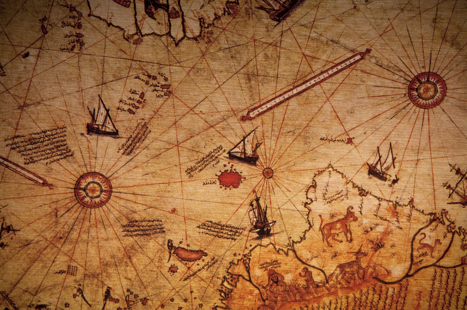
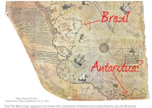
The Piri Reis map has stirred commotion since the moment of its discovery. Compiled in 1513, it is one of the oldest post-Columbian world maps in existence. Drawn on gazelle skin by Ottoman admiral and cartographer Piri Reis, the map blends remarkable detail with mystery.
Ahmet Muhiddin Piri — better known as Piri Reis — was not only a naval commander but also a skilled geographer. His map captures Europe, Africa, the Americas, and even lands that remain a matter of dispute.
Brief History
On October 9, 1929, German theologian Gustav Adolf uncovered the fragment in Istanbul’s Topkapı Palace. Identified as the work of Piri Reis, it stunned scholars with its accuracy: the Americas were depicted in surprising detail, and South America was shown in correct longitudinal relation to Africa. Even more shocking was what appeared to be Antarctica — nearly 300 years before its European discovery.
Anomalies and Mysteries
The map presents anomalies that challenge conventional history:
-
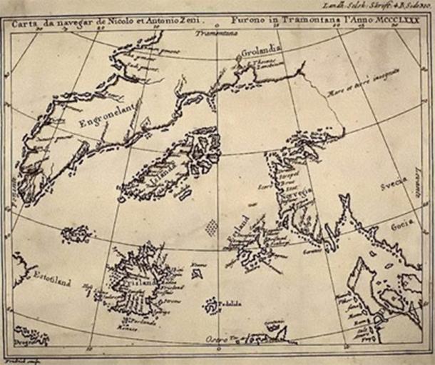
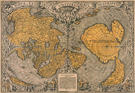
Antarctica Debate – Some believe the map shows Antarctica, possibly even without its ice cap, suggesting knowledge of the continent thousands of years before modern discovery.
-
Mercator Projection – The chart seems to employ techniques of the Mercator projection decades before its official invention in the 1560s.
-
Advanced Sources – Charles Hapgood and his students argued the accuracy implied access to ancient maps, possibly as old as 4,000 BCE, or even aerial surveying technology.
These anomalies raise questions: Was Piri Reis drawing from lost knowledge of forgotten civilizations? Or could it simply be distortions of the South American coastline, explained by the limited geography of the early 1500s?
A Map Ahead of Its Time
Whether Antarctica is truly depicted or not, the Piri Reis map controversy continues to fascinate. To some, it is evidence of advanced ancient cartography, perhaps preserved from civilizations erased from history. To others, it is a brilliant — but flawed — amalgamation of the best maps of its era.
Either way, the Piri Reis map remains one of the most studied and debated artifacts, fueling legends of lost knowledge, alien intervention, and mysterious civilizations.

Related Articles in Our Series on Ancient Maps
And for more historical enigmas, explore:
-
Cart Ruts and Forgotten Civilizations: Traces of Cataclysmic History
-
The Cart Ruts of Syracuse: Ancient Tracks of Forgotten Civilizations
-
Cart Ruts in the USA: Ancient Tracks from Texas to California
References
_______________________________________________________________________________________
- Tchakarov, Vladislav. Most Controversial Map in History; What Secrets Does the Piri Reis Map Hold? 3 Nov. 2020, curiosmos.com/most-controversial-map-in-history-what-secrets-does-the-piri-reis-map-hold/.
- Team, Ancient Code. “Before Antarctica Was Covered in Ice-Someone Mapped It with Extreme Precision.” Ancient Code, 27 Feb. 2018, ancient-code.com/antarctica-covered-ice-someone-mapped-extreme-precision/
- Conner, Isaac. Piri Reis Map that could change the world. 14 Apr.. 2021, University of Richmond University Department of Rhetoric and Communication Studies https://blog.richmond.edu/livesofmaps/.