
Gerardus Mercator Map of Antarctica
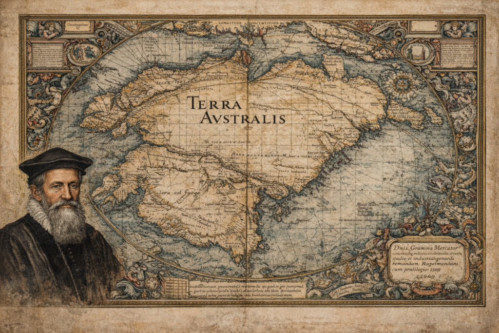
The Sources and Historical Context of the Gerardus Mercator Map The Gerardus Mercator map represents one of the most influential and scrutinized artifacts in the history of cartography, depicting a southern continent long before Antarctica was officially discovered. Created in 1569 as part of Mercator’s groundbreaking world map, it incorporates the hypothetical landmass of Terra […]
Philippe Buache Map of Antartica
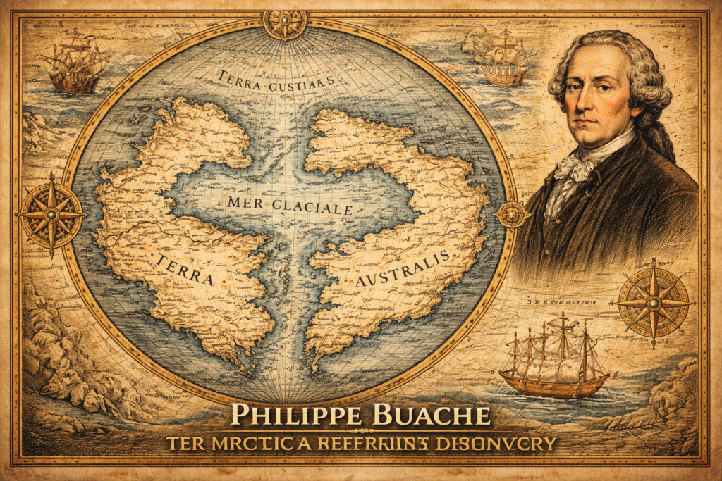
The Sources and Historical Context of the Philippe Buache Map The Philippe Buache map represents one of the most debated artifacts in the history of cartography, presenting a depiction of Antarctica that appears to include structural geographic features long before the continent was officially discovered in the nineteenth century, thereby raising fundamental questions regarding the […]
The Piri Reis Map Sources
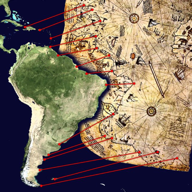
A Map That Continues to Puzzle Scholars and Enthusiasts Alike On October 9, 1929, while cataloguing neglected manuscripts in Istanbul’s Topkapı Palace, German theologian Gustav A. Deissmann unearthed a bundle of parchment charts that had lain forgotten for centuries. Among them was a curious fragment drawn in 1513 by Hacı Ahmed Muhiddin Piri — better known as Piri Reis — depicting coastlines […]
