
Ancient Maps and Star Charts: Lost Knowledge Traditions

Mapping the Cosmos and the Earth The history of civilization is inseparable from the history of mapping. From the earliest symbolic engravings to sophisticated world charts, ancient maps and star charts represent humanity’s attempt to understand space, time, and cosmic order. Ancient maps, star and constellation charts, lost knowledge of an advanced civilization. These artifacts […]
Cosmic Orientation of Ancient Cities

When Civilization Followed the Heavens Throughout antiquity, humanity did not build randomly upon the surface of the Earth. Across continents separated by vast oceans, ancient civilizations constructed cities, monuments, ceremonial centers, and sacred landscapes that appear deliberately oriented according to celestial phenomena. The cosmic orientation of ancient cities reveals a remarkable and recurring phenomenon: the […]
The Zeno Map: An Atlantic Cartographic Enigma

Phantom Islands in the North Atlantic The Zeno Map, first published in Venice in 1558, is one of the most enigmatic cartographic artifacts of the Renaissance. Allegedly based on the voyages of two 14th-century Venetian brothers, Nicolò and Antonio Zeno, it depicts a cluster of islands—Frisland, Icaria, Estotiland, and Drogeo—lying between Iceland, Greenland, and the […]
Gerardus Mercator Map of Antarctica
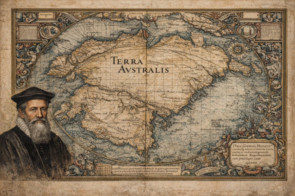
The Sources and Historical Context of the Gerardus Mercator Map The Gerardus Mercator map represents one of the most influential and scrutinized artifacts in the history of cartography, depicting a southern continent long before Antarctica was officially discovered. Created in 1569 as part of Mercator’s groundbreaking world map, it incorporates the hypothetical landmass of Terra […]
Philippe Buache Map of Antartica
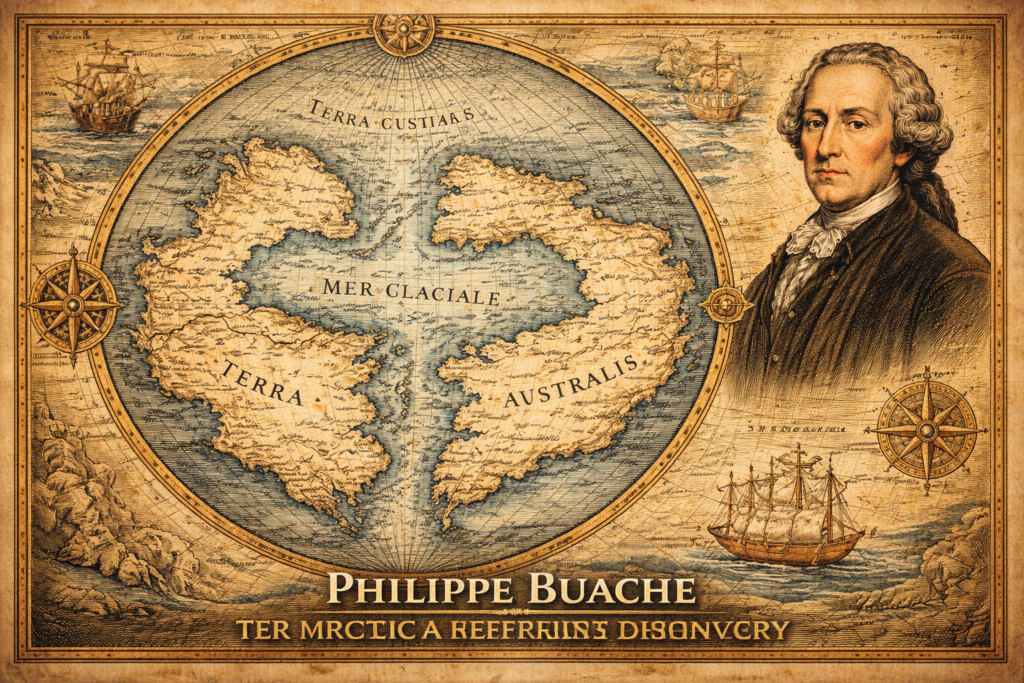
The Sources and Historical Context of the Philippe Buache Map The Philippe Buache map represents one of the most debated artifacts in the history of cartography, presenting a depiction of Antarctica that appears to include structural geographic features long before the continent was officially discovered in the nineteenth century, thereby raising fundamental questions regarding the […]
Terra Australis Hypothesis
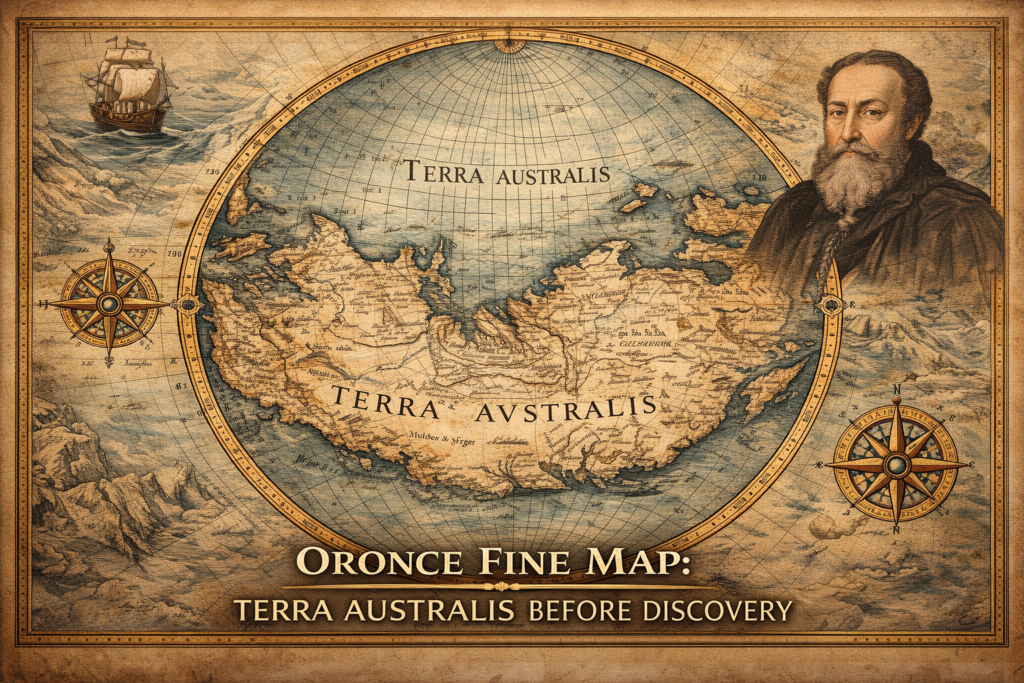
The Terra Australis Hypothesis and the Legacy of Ancient Cartography The terra australis hypothesis represents one of the most intriguing questions in the history of geographic knowledge, suggesting that a vast southern continent was mapped and theorized centuries before the modern discovery of Antarctica, raising fundamental questions about how early civilizations understood the world and […]
