Landscapes Lost to Water and Time
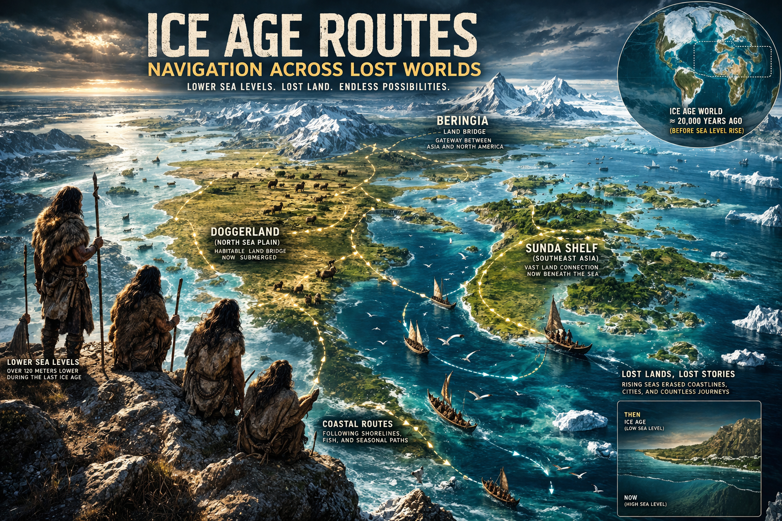
The investigation into submerged civilizations begins not with speculation, but with a well-established geological reality: at the peak of the last Ice Age, global sea levels were dramatically lower than they are today, exposing vast continental shelves that are now submerged beneath oceans, and transforming coastlines into expansive habitable regions that would have supported human populations for thousands of years (Lost Knowledge of the Ice Rewriting History link). As the planet transitioned out of the Last Glacial Maximum, melting ice sheets triggered a series of rapid sea-level rises, in some cases occurring in pulses that would have reshaped coastlines within relatively short timeframes, submerging settlements, altering ecosystems, and forcing human communities to migrate inland or adapt to changing environments (Younger Dryas Impact Hypothesis Explained link). This process, while gradual on geological timescales, would have been profound from a human perspective, potentially erasing entire landscapes along with the archaeological record they contained (Ice Age Lost Worlds Before the Flood link).
What complicates the modern understanding of early human development is that these now-submerged regions were not peripheral zones but likely central to human habitation, given their access to water, food resources, and transportation routes, meaning that a significant portion of prehistoric human activity may currently lie beyond the reach of traditional archaeology (Ice Age Science Before the Younger Dryas link and the Older Dryas Climate link. As underwater exploration technologies improve, new discoveries are beginning to reveal traces of these lost landscapes, suggesting that the absence of evidence for early complex societies may be more a reflection of where we have looked than what actually existed (Ice Age Civilization Lost World Before the Flood link). Within this context, the concept of submerged civilizations does not necessarily imply advanced urban societies in the modern sense, but rather invites a reassessment of the scale, organization, and knowledge systems of prehistoric coastal populations whose material legacy may now rest beneath the sea (Lost Knowledge Before Written History link).
Sea-Level Rise — The Mechanism of Disappearance
The transition from the Ice Age to the current interglacial period involved a global sea-level rise of approximately 120 meters, a transformation driven primarily by the melting of massive ice sheets that once covered large portions of North America, Europe, and Asia, and while this process unfolded over several millennia, it was not uniform or continuous, as geological evidence points to episodes of accelerated melting known as meltwater pulses, during which sea levels may have risen several meters within a few centuries or even decades (Mappy the Sky Before Civilization link). Such events would have had dramatic consequences for coastal populations, inundating low-lying areas, fragmenting territories, and potentially displacing communities that had developed stable patterns of habitation over generations (Philippe Buache Map of Antartica link).
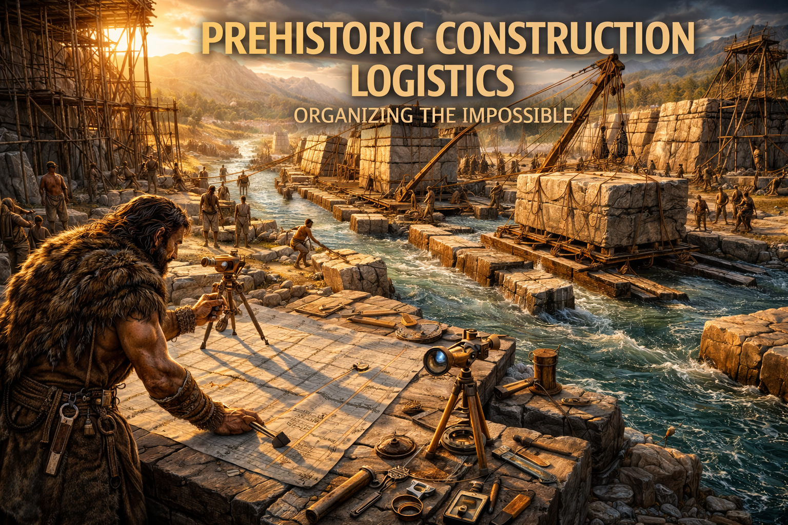
As there is the possibility of lost knowledge of lost civilizations beneath the sand (link), there is also the same possibility that important chapters of our history are lost beneath the water. To support this hypothesis, across the world we could also find several anomalies and evidence of a lost global civilization; examples? Ancient Maps (link). From an archaeological perspective, this presents a significant challenge, because the areas most likely to contain evidence of early settlement—river deltas, coastal plains, and shallow continental shelves—are precisely those that were most affected by rising seas, meaning that entire regions of human activity may now be submerged at depths that are difficult to explore (Cycles of Time Civilizations and Recurrence link). This raises an important methodological question: how can the history of early human societies be reconstructed when a substantial portion of the evidence lies underwater, and how might future discoveries in these environments alter current models of human development?
Doggerland: A Lost European Landscape
One of the most well-documented examples of a submerged prehistoric landscape is Doggerland, a region that once connected Britain to continental Europe and supported human populations during the Mesolithic period, before being gradually inundated by rising sea levels and possibly catastrophic flooding events. Archaeological findings, including tools, animal remains, and evidence of human habitation, indicate that Doggerland was not an isolated or marginal environment but a thriving ecosystem that sustained complex patterns of life.
The study of Doggerland has been made possible in part by advances in marine geology and the analysis of sediment cores, which allow researchers to reconstruct past environments and identify areas of potential archaeological interest. These methods have revealed river systems, forests, and wetlands that would have provided abundant resources for human populations, reinforcing the idea that submerged landscapes may hold key insights into early human development.
Yonaguni Monument: Natural Formation or Human Design?
Off the coast of Japan, the Yonaguni Monument presents one of the most debated underwater structures in the world, consisting of large, geometric formations that some researchers interpret as the remains of a man-made structure, while others argue that they are the result of natural geological processes such as fracturing and erosion. The site features terraces, flat surfaces, and sharp angles that appear unusually regular, leading to speculation about human involvement, yet the absence of definitive artifacts or inscriptions makes it difficult to draw firm conclusions.
From a scientific standpoint, the Yonaguni structure highlights the importance of caution in interpreting underwater formations, as natural processes can produce patterns that resemble human construction, particularly in sedimentary rock formations subject to tectonic activity. At the same time, the site underscores the need for continued investigation, as the possibility of human modification cannot be entirely ruled out without more comprehensive evidence.
Bimini Road: Structure or Geological Phenomenon?
The Bimini Road, located in the Bahamas, consists of a linear arrangement of large limestone blocks that has been interpreted by some as the remains of an ancient roadway or wall, while geologists generally attribute its formation to natural processes such as beachrock fracturing and erosion (Ancient Maps, Knowledge Before Modern Cartography link). The alignment and apparent organization of the stones have fueled speculation about its origin, particularly in connection with theories of lost civilizations, yet detailed studies have found that similar formations can occur naturally under specific environmental conditions.
Despite the prevailing scientific interpretation, the Bimini Road remains a subject of interest because it illustrates how underwater features can challenge assumptions and encourage further investigation, even when initial explanations favor natural processes. It also highlights the importance of distinguishing between evidence and interpretation, particularly in a field where direct observation is often limited.
Cuban Underwater Structures: An Unresolved Case
Reports of submerged structures off the coast of Cuba, identified through sonar imaging, have generated significant interest due to their apparent geometric patterns and depth, which suggests that if they are artificial, they would date to a period when sea levels were significantly lower than today. However, the lack of direct exploration and verification has left the nature of these formations unresolved, with some researchers suggesting natural explanations while others call for further investigation.
The Cuban case exemplifies both the potential and the limitations of underwater archaeology, where preliminary data can raise compelling questions but definitive answers require extensive and often costly exploration efforts.
Gulf of Cambay: Early Urban Evidence or Misinterpretation?
In the Gulf of Cambay (Khambhat) in India, sonar surveys have revealed structures and artifacts that some researchers have interpreted as evidence of an ancient settlement, possibly dating back several thousand years, yet the findings remain controversial due to issues related to data quality, sample context, and interpretation. While some materials recovered from the site have been dated to prehistoric periods, establishing a clear connection between these artifacts and the sonar-detected structures has proven challenging.
This case highlights the complexities of interpreting underwater data, where multiple variables can influence results, and underscores the need for rigorous methodology in distinguishing between natural formations, displaced artifacts, and genuine archaeological sites.
Mu and Global Flood Traditions: Cultural Echoes of Environmental Change
The idea of a lost continent such as Mu, often described in early speculative literature, does not have empirical support within modern geology, yet it occupies a place within the broader context of global narratives that describe lands lost to the sea, narratives that appear across cultures and historical periods, suggesting a shared human experience of environmental transformation rather than a single, unified historical event. When examined alongside scientifically supported evidence of sea-level rise and climatic disruption at the end of the Ice Age, these traditions may be understood as cultural responses to real changes in the environment, encoded in mythological language and transmitted across generations.
Rather than treating such narratives as literal accounts, a more productive approach is to consider them as reflections of human memory and perception, providing insight into how ancient communities interpreted and preserved experiences of change, loss, and adaptation.
Underwater Archaeology — A Field in Its Infancy
The exploration of submerged landscapes remains one of the most promising yet underdeveloped areas of archaeology, constrained by technical, financial, and logistical challenges, yet increasingly supported by advances in technology such as sonar mapping, remotely operated vehicles, and satellite imaging, which are expanding the scope of what can be discovered and analyzed. As these tools become more accessible and refined, the potential for identifying and investigating submerged sites will continue to grow, offering new opportunities to test hypotheses about early human societies and their environments.
Conclusion: A History Beneath the Surface
The study of submerged civilizations does not seek to overturn established knowledge but to expand it, acknowledging that the current understanding of human history is shaped not only by what has been discovered but also by what remains hidden, and as research continues to push the boundaries of exploration, the possibility remains that significant chapters of human development lie beneath the oceans, waiting to be uncovered. Whether these submerged landscapes reveal simple settlements or more complex societies, their investigation will undoubtedly contribute to a more nuanced and comprehensive understanding of the past, reminding us that history is not fixed but continually evolving as new evidence comes to light.
References and Further Reading
Encyclopaedia Britannica — Sea-Level Change
NOAA — Underwater Archaeology (link)
Nature — Meltwater Pulse Studies (link)
Journal of Marine Archaeology (link)
Ancient360 Library — Cartography and Lost Landscapes (link)