
Submerged Caribbean City — 6000 Year Underwater Discovery

Submerged Caribbean City — 6000 Year Underwater Discovery The submerged Caribbean city discovery has become one of the most controversial and fascinating underwater archaeological findings of the modern era, raising profound questions about human antiquity, ancient engineering capabilities, and the possibility that complex civilizations existed far earlier than conventional historical timelines suggest. According to reports, […]
Ancient Knowledge Networks: Mapping Earth and Sky

Connecting Earth, Sky, and Knowledge The concept that ancient civilizations integrated knowledge of the Earth and the heavens sky into a unified scientific framework appears repeatedly across archaeological discoveries, historical texts, and architectural remains, suggesting that early societies may have possessed sophisticated systems of navigation, surveying, and environmental understanding that connected terrestrial geography with celestial […]
The Zeno Map: An Atlantic Cartographic Enigma

Phantom Islands in the North Atlantic The Zeno Map, first published in Venice in 1558, is one of the most enigmatic cartographic artifacts of the Renaissance. Allegedly based on the voyages of two 14th-century Venetian brothers, Nicolò and Antonio Zeno, it depicts a cluster of islands—Frisland, Icaria, Estotiland, and Drogeo—lying between Iceland, Greenland, and the […]
Gerardus Mercator Map of Antarctica
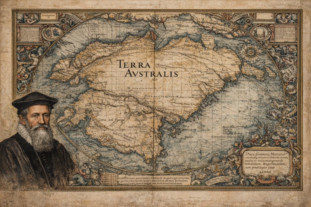
The Sources and Historical Context of the Gerardus Mercator Map The Gerardus Mercator map represents one of the most influential and scrutinized artifacts in the history of cartography, depicting a southern continent long before Antarctica was officially discovered. Created in 1569 as part of Mercator’s groundbreaking world map, it incorporates the hypothetical landmass of Terra […]
Philippe Buache Map of Antartica
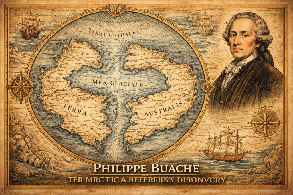
The Sources and Historical Context of the Philippe Buache Map The Philippe Buache map represents one of the most debated artifacts in the history of cartography, presenting a depiction of Antarctica that appears to include structural geographic features long before the continent was officially discovered in the nineteenth century, thereby raising fundamental questions regarding the […]
Terra Australis Hypothesis
The Terra Australis Hypothesis and the Legacy of Ancient Cartography The terra australis hypothesis represents one of the most intriguing questions in the history of geographic knowledge, suggesting that a vast southern continent was mapped and theorized centuries before the modern discovery of Antarctica, raising fundamental questions about how early civilizations understood the world and […]
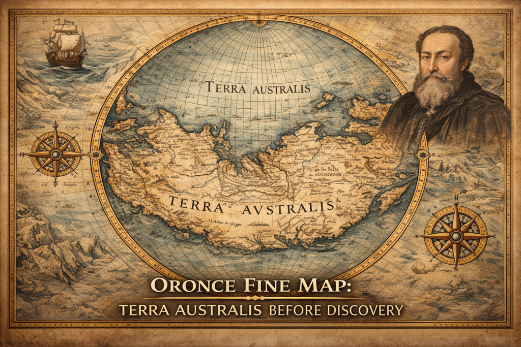
Oronce Fine Map of Antarctica
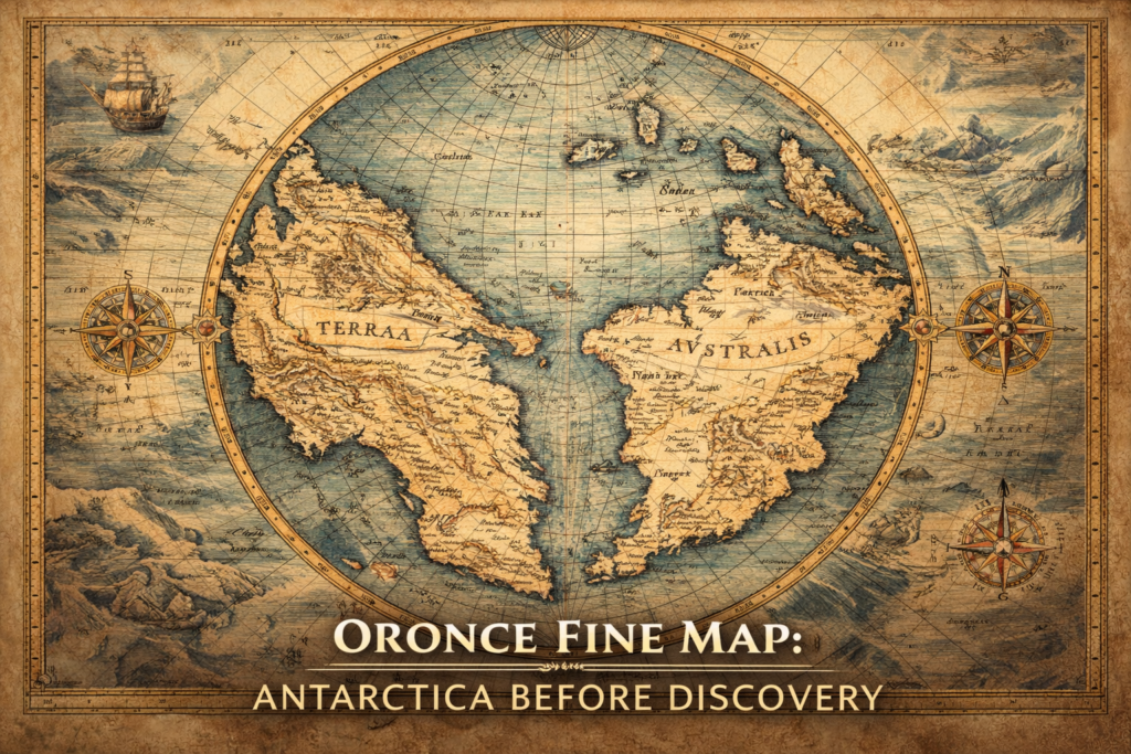
The Oronce Fine Map represents one of the earliest and most controversial depictions of a southern polar continent, portraying a massive landmass in the Antarctic region nearly three centuries before the official discovery of Antarctica, and raising profound questions about the sources of early geographic knowledge and the intellectual frameworks through which Renaissance scholars attempted […]
Philippe Buache Map of Antarctica
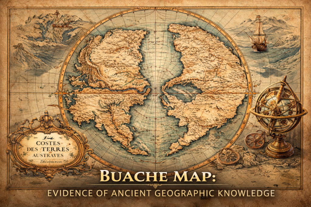
The Buache Map of Ancinet Antarctica represents one of the most perplexing documents in the history of cartography, presenting a detailed representation of the Antarctic continent decades before its official discovery and suggesting an advanced understanding of polar geography that continues to provoke debate regarding the origins of early geographic knowledge and the possibility of […]
Ancient Hyper-Forests and Giant Trees

The Biological Scale of a Different Planet The hypothesis of ancient hyper-forests proposes that Earth once sustained ecological systems operating at physical scales far beyond those observable today, where trees may have reached heights measured not merely in hundreds of meters (hundreds of feet) but potentially approaching several kilometers (thousands of feet), supported by atmospheric […]
The Zeno Map History
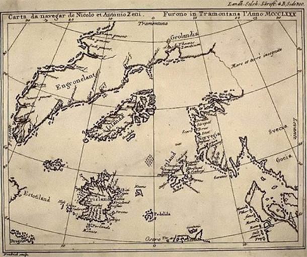
The Zeno Map History and the Problem of Forgotten Geography The Zeno Map history occupies a controversial yet fascinating position within the study of ancient maps. First published in 1558 by Nicolo Zeno the Younger, the map was claimed to be based on far older navigational charts and letters written by his ancestors, the Venetian […]
