Skip to content
  • Ancient Maps
  • Archeoastronomy
  • Cosmic Alignments
  • Megalithic Structures
  • Geoglyphs
  • Sacred Geometry
  • Latest Videos
Menu
  • Ancient Maps
  • Archeoastronomy
  • Cosmic Alignments
  • Megalithic Structures
  • Geoglyphs
  • Sacred Geometry
  • Latest Videos
Facebook-f Instagram
Early cartographic depiction of Terra Australis in Renaissance world maps.

Terra Australis Hypothesis

February 25, 2026

The Terra Australis Hypothesis and the Legacy of Ancient Cartography The terra australis hypothesis represents one of the most intriguing

Read More »
Nova, et integra universi orbis descriptio Creator Fine, Oronce, 1494-1555

Oronce Fine Map of Antarctica

February 23, 2026

The Oronce Fine Map represents one of the earliest and most controversial depictions of a southern polar continent, portraying a

Read More »
Buache map Antarctica divided continent

Philippe Buache Map of Antarctica

February 23, 2026

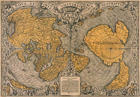
The Buache Map of Ancinet Antarctica represents one of the most perplexing documents in the history of cartography, presenting a

Read More »
ancient navigation using stars and celestial mapping

Ancient Navigation Technology: Evidence of Lost Survey Methods

February 23, 2026

The Mystery of Ancient Navigation The study of ancient navigation reveals one of the most profound and underexplored questions in

Read More »
Antarctica mapping ancient world map showing ice-free continent

Antarctica Mapping Before Discovery

February 23, 2026

The Antarctica Mapping Enigma The mystery of Antarctica mapping in ancient cartographic documents raises profound questions about humanity’s forgotten past,

Read More »
ancient maps anomaly showing prehistoric world map with Antarctica

Ancient Maps Anomaly: Evidence of a Lost Global Civilization

February 23, 2026

The ancient maps anomaly represents one of the most controversial and intellectually disruptive fields of historical investigation, because several medieval

Read More »
A high-resolution scan of the Zeno Map showing Frisland, Greenland, and the North Atlantic.

The Zeno Map History

January 21, 2026

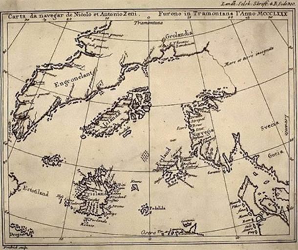
The Zeno Map History and the Problem of Forgotten Geography The Zeno Map history occupies a controversial yet fascinating position

Read More »
Full-frame view of Piri Reis' world map. (iStock Photo)

Piri Reis Map and the Impossible Coastlines

January 21, 2026

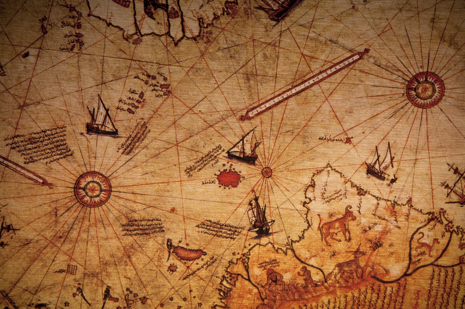
The Piri Reis Map and the Impossible Coastlines The Piri Reis map history occupies a unique and controversial position within

Read More »
The Oronteus Finaeus map showing ice-free Antarctica and ancient coastlines

The Oronteus Finaeus Map: Antarctica Before Ice

January 21, 2026

The Oronteus Finaeus Map: Antarctica Before Ice The Oronteus Finaeus map is one of the most unsettling artifacts in the

Read More »
Ancient Maps: Knowledge Before Modern Cartography

Ancient Maps of a Drowned World: Echoes of Lost Civilizations

January 21, 2026

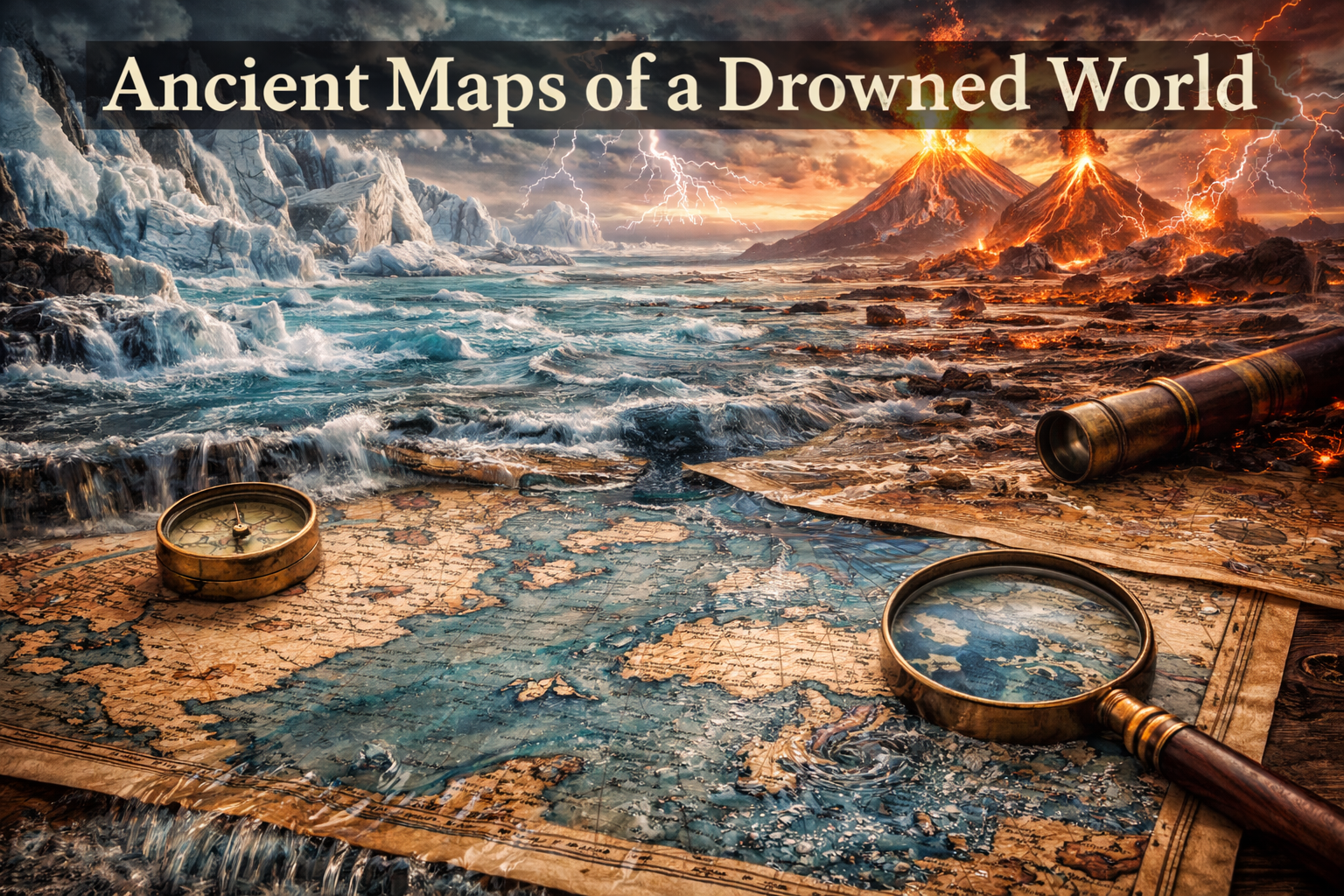
Ancient Maps of a Drowned World: Echoes of Lost Civilizations The concept of an ancient maps drowned world challenges conventional

Read More »
Page1 Page2 Page3 Page4
Latest Video
Most Popular
Ancient Water Systems
May 18, 2026
Acoustic Engineering Ancient Structures
May 17, 2026
Stone Functional Material
May 17, 2026
Lost Ancient Technologies
Systems vs Tools: Reconstructing Lost Ancient Technologies
May 14, 2026
Categories
  • Ancient Maps (34)
  • Archeoastronomy (22)
  • Cosmic Alignments (17)
  • Foundations (59)
  • Geoglyphs (11)
  • Megalithic Structures (72)
  • Sacred Geometry (44)

COMPLETE YOUR JOURNEY

RECEIVE UPDATED STORIES FROM THE ANCIENT MASTERS

Ancient360 © 2022 ALL RIGHTS RESERVED.

Disclamer

Facebook-f Instagram